The Great London Mosque in Brick Lane
Introduction
The photograph on this page of The Great London Mosque in Brick Lane by Natasha Ceridwen de Chroustchoff as part of the Geograph project.
The Geograph project started in 2005 with the aim of publishing, organising and preserving representative images for every square kilometre of Great Britain, Ireland and the Isle of Man.

There are currently over 7.5m images from over 14,400 individuals and you can help contribute to the project by visiting https://www.geograph.org.uk
The Great London Mosque in Brick Lane
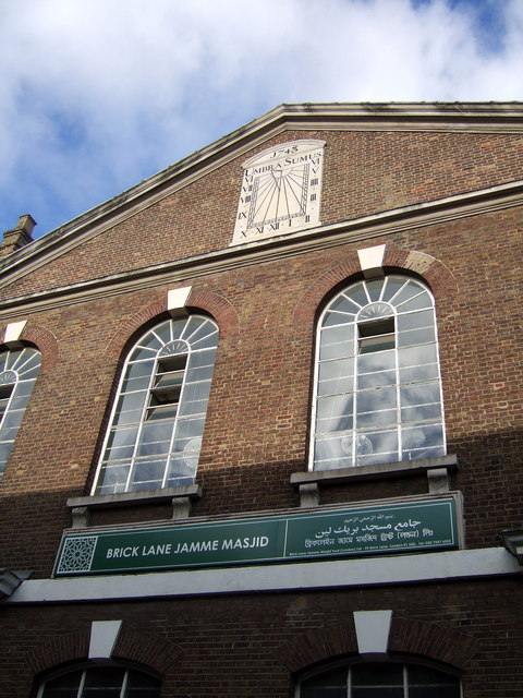
Image: © Natasha Ceridwen de Chroustchoff Taken: 21 Jan 2007
On the corner of Fournier Street, this was originally founded as a church for Huguenots who fled to London to avoid persecution in France. The chapel was later used by Methodists and in the late 19th century, when Whitechapel became the centre of the Jewish East End, it became the Machzike Adass, also known as the Spitalfields Great Synagogue. With the dispersal of the Jewish community and a new influx of Bengali immigrants, it became the Jamme Masjid or Great London Mosque in 1976. The sundial at the top is dated 1743 with the words UMBRA SUMUS above the hours.
Images are licensed for reuse under creativecommons.org/licenses/by-sa/2.0
Image Location
Latitude
51.519439
Longitude
-0.07165