IMAGES TAKEN NEAR TO
Bartlett Close, LONDON, E14 6LH

Introduction

This page details the photographs taken nearby to Bartlett Close, E14 6LH by members of the Geograph project.

The Geograph project started in 2005 with the aim of publishing, organising and preserving representative images for every square kilometre of Great Britain, Ireland and the Isle of Man.

There are currently over 7.5m images from over14,400 individuals and you can help contribute to the project by visiting https://www.geograph.org.uk

Image Map


Images are licensed for reuse under creativecommons.org/licenses/by-sa/2.0
Notes
  • Clicking on the map will re-center to the selected point.
  • The higher the marker number, the further away the image location is from the centre of the postcode.

Image Listing (66 Images Found)

Images are licensed for reuse under creativecommons.org/licenses/by-sa/2.0
  • ...
Image
Details
Distance
1
St. Saviour, Northumbria Street, Poplar
Image: © Chris Whippet Taken: 8 Jan 2009
0.01 miles
2
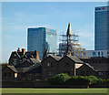
Church of St Saviour, Poplar
Grade II listed church dating from 1873-4 to a design by Frederick J and Horace Francis. Declared redundant in 1984, listed in 1989, but severely damaged by fire in May 2007 and is currently propped by scaffolding. Pre-fire description at this https://historicengland.org.uk/listing/the-list/list-entry/1242275.
Image: © Jim Osley Taken: 10 May 2017
0.02 miles
3
Church of St Saviour from the air
A derelict church surrounded by a cluster of houses in an area of parkland. See Image for more information.
Image: © Thomas Nugent Taken: 26 Aug 2019
0.03 miles
4
Limehouse, Bartlett Park
Tower Hamlets park with football pitches and playground.
Image: © Mike Faherty Taken: 26 Aug 2012
0.07 miles
5
Limehouse Cut
Looking north-east towards Bow Common Lane bridge. The development on the left is Silver Wharf the construction of which can be seen in Image
Image: © David Kemp Taken: 1 Nov 2010
0.10 miles
6
Abbott's Walk moorings, Limehouse Cut
In former years, London's urban canals had many small docks where one or two boats could be moored off the main route while loading or unloading took place. Many of these have disappeared, but their successors are private side moorings available to nearby residents where a few narrow boats can be kept.
Image: © Dr Neil Clifton Taken: 3 Sep 2008
0.10 miles
7
Bow Common from the air
Limehouse Cut can be seen to the lower right.
Image: © Thomas Nugent Taken: 26 Aug 2019
0.11 miles
8
Augusta Street, Poplar
Image: © Chris Whippet Taken: 8 Jan 2009
0.11 miles
9
Chrisp Street Market, Poplar
The Chrisp Street retail centre is on the Lansbury Estate, which was part of the 1951 Festival of Britain and was the first specially designed pedestrianised shopping centre in the UK.
Image: © David Bradbury Taken: 13 Aug 2005
0.11 miles
10
The Isle of Dogs from the air
Looking south on a gloomy day, the great loop and the buildings at Canary Wharf are prominent. The O2 Arena can be seen on the left, as can the River Lea or Lee.
Image: © Thomas Nugent Taken: 31 Jul 2015
0.11 miles
  • ...