The Isle of Dogs from the air
Introduction
The photograph on this page of The Isle of Dogs from the air by Thomas Nugent as part of the Geograph project.
The Geograph project started in 2005 with the aim of publishing, organising and preserving representative images for every square kilometre of Great Britain, Ireland and the Isle of Man.

There are currently over 7.5m images from over 14,400 individuals and you can help contribute to the project by visiting https://www.geograph.org.uk
The Isle of Dogs from the air
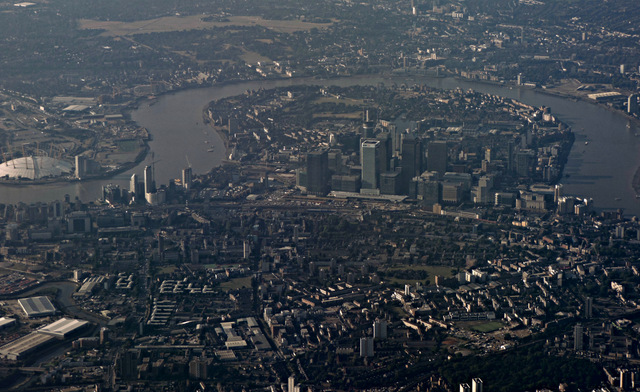
Image: © Thomas Nugent Taken: 31 Jul 2015
Looking south on a gloomy day, the great loop and the buildings at Canary Wharf are prominent. The O2 Arena can be seen on the left, as can the River Lea or Lee.
Images are licensed for reuse under creativecommons.org/licenses/by-sa/2.0
Image Location
Latitude
51.515697
Longitude
-0.019777