
IMAGES TAKEN NEAR TO
Ferry Street, LONDON, E14 3FA
Introduction
This page details the photographs taken nearby to Ferry Street, E14 3FA by members of the Geograph project.
The Geograph project started in 2005 with the aim of publishing, organising and preserving representative images for every square kilometre of Great Britain, Ireland and the Isle of Man.

There are currently over 7.5m images from over14,400 individuals and you can help contribute to the project by visiting https://www.geograph.org.uk
Image Map
Images are licensed for reuse under creativecommons.org/licenses/by-sa/2.0
Notes
- Clicking on the map will re-center to the selected point.
- The higher the marker number, the further away the image location is from the centre of the postcode.
Image Listing (404 Images Found)
Images are licensed for reuse under creativecommons.org/licenses/by-sa/2.0
Image
Details
Distance
1
Footpath to Island Gardens Station
Island Gardens Station is on the Docklands Light Railway; and is the first stop, to the north, after the DLR has passed under the River Thames.
Image: © Peter Trimming
Taken: 7 May 2009
0.01 miles
2
Lane leading to Island Gardens station
Island Gardens is a Docklands Light Railway station on the line from Lewisham to Bank.
Image: © Jim Barton
Taken: 12 Dec 2013
0.02 miles
3
Path from Saunders Ness Road to Manchester Road
Image: © Basher Eyre
Taken: 6 Sep 2014
0.02 miles
4
Ferry Street, Isle of Dogs
View towards Canary Wharf.
Image: © Peter Trimming
Taken: 7 May 2009
0.02 miles
5
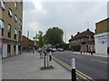
Looking west-northwest in Manchester Road
Image: © Basher Eyre
Taken: 6 Sep 2014
0.02 miles
7
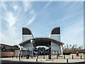
Island Gardens DLR Station, London E14
This station is close to the Greenwich Foot Tunnel.
Image: © Christine Matthews
Taken: 12 Mar 2015
0.02 miles
8

View from Greenwich toward the Isle of Dogs.
This was taken from a 'Big Wheel' that was temporarily erected in Greenwich during Summer 2008 on the riverfront behind the Old Naval College. The dome in the bottom right foreground is the entrance/exit of the Greenwich foot tunnel.
Image: © Anon
Taken: 23 Jul 2008
0.02 miles
9
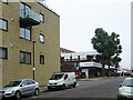
North Greenwich railway station (site), Greater London
Opened in 1872 by the London & Blackwall Railway as the terminus on the line from Millwall Junction, this terminus station closed in 1926.
View south towards the buffers from the road. The line was on a viaduct to the left, with an entrance building at the end of the nearer modern building. The later first Island Gardens DLR station was where this building now is.
For more information, see http://www.disused-stations.org.uk/n/north_greenwich/index.shtml
Image: © Nigel Thompson
Taken: 16 Nov 2018
0.03 miles
10
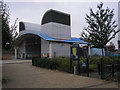
Island Gardens station, Docklands Light Railway
The scene here has changed greatly many times over the years. This is the southern tip of the Isle of Dogs, and a settlement known as Cubitt Town grew up with small terrace houses occupied by dockworkers and others connected with the river. A railway first came here in 1872 and a station known as North Greenwich (Cubitt Town) was opened, but it was a short way further south than the above, very close to the River Thames. This railway closed to passengers as early as 1926, but in 1987 the first section of the Docklands Light Railway opened, using the viaduct of the former line and with a high-level station very close to the above site: see Image With the construction of the DLR Lewisham extension in the late 1990s, the line had to be lowered so that a tunnel under the Thames could be constructed, so the high level Island Gardens station was demolished and replaced with the present underground station whose entrance is seen above.
Image: © Dr Neil Clifton
Taken: 12 Oct 2007
0.04 miles