Island Gardens station, Docklands Light Railway
Introduction
The photograph on this page of Island Gardens station, Docklands Light Railway by Dr Neil Clifton as part of the Geograph project.
The Geograph project started in 2005 with the aim of publishing, organising and preserving representative images for every square kilometre of Great Britain, Ireland and the Isle of Man.

There are currently over 7.5m images from over 14,400 individuals and you can help contribute to the project by visiting https://www.geograph.org.uk
Island Gardens station, Docklands Light Railway
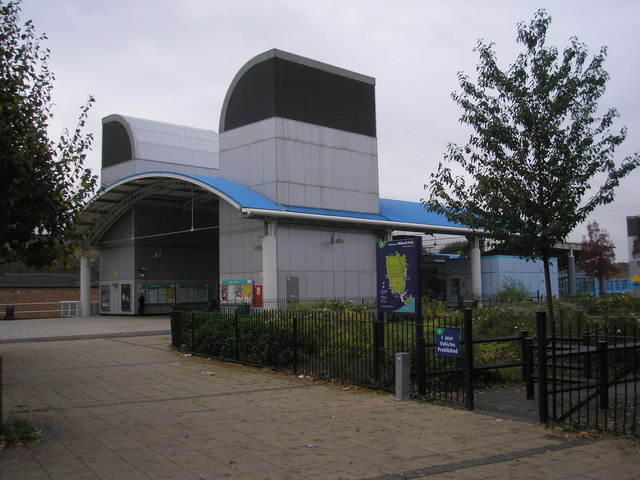
Image: © Dr Neil Clifton Taken: 12 Oct 2007
The scene here has changed greatly many times over the years. This is the southern tip of the Isle of Dogs, and a settlement known as Cubitt Town grew up with small terrace houses occupied by dockworkers and others connected with the river. A railway first came here in 1872 and a station known as North Greenwich (Cubitt Town) was opened, but it was a short way further south than the above, very close to the River Thames. This railway closed to passengers as early as 1926, but in 1987 the first section of the Docklands Light Railway opened, using the viaduct of the former line and with a high-level station very close to the above site: see Image With the construction of the DLR Lewisham extension in the late 1990s, the line had to be lowered so that a tunnel under the Thames could be constructed, so the high level Island Gardens station was demolished and replaced with the present underground station whose entrance is seen above.
Images are licensed for reuse under creativecommons.org/licenses/by-sa/2.0
Image Location


Leaflet Map data © OpenStreetMap
Latitude
51.487669
Longitude
-0.010909