IMAGES TAKEN NEAR TO
Seymour Road, LONDON, E10 7LX
Introduction
This page details the photographs taken nearby to Seymour Road, E10 7LX by members of the Geograph project.
The Geograph project started in 2005 with the aim of publishing, organising and preserving representative images for every square kilometre of Great Britain, Ireland and the Isle of Man.

There are currently over 7.5m images from over14,400 individuals and you can help contribute to the project by visiting https://www.geograph.org.uk
Image Map
Images are licensed for reuse under creativecommons.org/licenses/by-sa/2.0
Notes
- Clicking on the map will re-center to the selected point.
- The higher the marker number, the further away the image location is from the centre of the postcode.
Image Listing (37 Images Found)
Images are licensed for reuse under creativecommons.org/licenses/by-sa/2.0
Image
Details
Distance
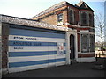
1
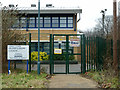
Students entrance gate, Lammas School
Only open 08:20 to 08:30 according to the sign.
Image: © Robin Webster
Taken: 15 Jan 2011
0.04 miles
2
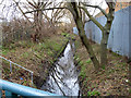
Dagenham Brook
A drain that seems to have little to do with the more well-known Dagenham.
Image: © Robin Webster
Taken: 15 Jan 2011
0.09 miles
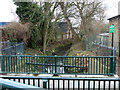
3
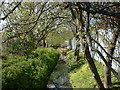
Dagenham Brook
Dagenham Brook looking North from Marsh Lane Leyton
Image: © Richard Dunn
Taken: 16 Apr 2004
0.10 miles
4
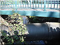
Leyton Marshes - Dagenham Brook
Footbridge over Dagenham Brook at Marsh Lane, E10. Willowbrook Primary School - My Walks - March 2012
Image: © P KAVANAGH
Taken: 27 Mar 2012
0.11 miles
5
Gatekeeper's House - Leyton Marshes
This house bears an inscription dedicated to the local people who fought to retain grazing rights on this common land. The fields were known as the Lammas fields, reflection of the time after lambing when anyone could use the land for grazing.
Image: © P KAVANAGH
Taken: 27 Mar 2012
0.12 miles
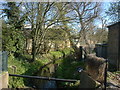
6
Dagenham Brook
Downstream from Marsh Lane bridge.
Image: © Robin Webster
Taken: 15 Jan 2011
0.13 miles
7
Dagenham Brook
Dagenham Brook looking south from Marsh Lane Leyton
Image: © Richard Dunn
Taken: 16 Apr 2004
0.14 miles
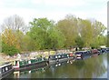
9
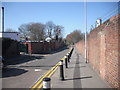
Marsh Lane E10
Route to Leyton Marshes - March 2012 - Willowbrook School My Walks
Image: © P KAVANAGH
Taken: 27 Mar 2012
0.15 miles
10
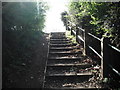
Steps to Scrub on Leyton Marshes E10
Informal footpath on Leyton Marshes leading up to raised level and Dagenham Brook new footbridge. Willowbrook Primary School - March 2012
Image: © P KAVANAGH
Taken: 27 Mar 2012
0.16 miles