
IMAGES TAKEN NEAR TO
Shenstone Avenue, STOURBRIDGE, DY8 3DZ
Introduction
This page details the photographs taken nearby to Shenstone Avenue, DY8 3DZ by members of the Geograph project.
The Geograph project started in 2005 with the aim of publishing, organising and preserving representative images for every square kilometre of Great Britain, Ireland and the Isle of Man.

There are currently over 7.5m images from over14,400 individuals and you can help contribute to the project by visiting https://www.geograph.org.uk
Image Map
Images are licensed for reuse under creativecommons.org/licenses/by-sa/2.0
Notes
- Clicking on the map will re-center to the selected point.
- The higher the marker number, the further away the image location is from the centre of the postcode.
Image Listing (40 Images Found)
Images are licensed for reuse under creativecommons.org/licenses/by-sa/2.0
Image
Details
Distance
1
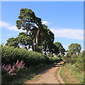
Roman Road near Norton in Stourbridge, Dudley
Looking north from near Elm Close (off Clent View Road), this sandy track is also known as Sandy Lane.
The route is not actually Roman in origin. It was constructed in the 18th century as part of a turnpike (toll) road linking Kidderminster and Dudley. (information - K. James, BSc).
The course of a former Roman Road between Droitwich and Greensforge passes close by across the fields, off to the left (west).
Image: © Roger Kidd
Taken: 7 Aug 2020
0.08 miles
2
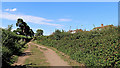
Roman Road near Norton in Stourbridge, Dudley
Looking north from near Elm Close (off Clent View Road), this sandy track is also known as Sandy Lane.
The route is not actually Roman in origin. It was constructed in the 18th century as part of a turnpike (toll) road linking Kidderminster and Dudley. (information - K. James, BSc).
The course of a former Roman Road between Droitwich and Greensforge passes close by across the fields, off to the left (west).
Image: © Roger Kidd
Taken: 7 Aug 2020
0.09 miles
3
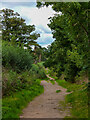
A bridleway on the border of Stourbridge
This bridleway runs along the edge of Norton, the suburban area to the South of Stourbridge. Part of this bridleway, further to the South, forms the remains of a Roman Road.
Image: © Oliver Mills
Taken: 18 Sep 2022
0.09 miles
5
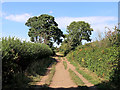
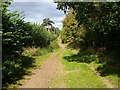
Sandy Lane near Norton in Stourbridge, Dudley
Looking north near Chestnut Close (off Clent View Road), this sandy track is also known as Roman Road. However, the route is not actually Roman in origin. It was constructed in the 18th century as part of a turnpike (toll) road linking Kidderminster and Dudley. (information - K. James, BSc).
The course of a former Roman Road between Droitwich and Greensforge passes close by across the fields, off to the left (west).
Image: © Roger Kidd
Taken: 7 Aug 2020
0.09 miles
6
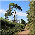
Roman Road near Stourbridge, Dudley
It is hard to imagine that this scene is about thirty metres from the housing (off to the right) in Clent View Road in Norton, Stourbridge. Looking north along Roman Road (also known as Sandy Lane), there is pasture and woodland off to the left behind the hedge.
The route is not actually Roman in origin. It was constructed in the 18th century as part of a turnpike (toll) road linking Kidderminster and Dudley. (information - K. James, BSc).
The course of the former Roman Road between Droitwich and Greensforge is about a hundred metres off to the left.
Image: © Roger Kidd
Taken: 7 Aug 2020
0.10 miles
7
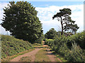
Roman Road near Norton in Stourbridge, Dudley
Looking south towards Sugar Plum Lane, this sandy track is also known as Sandy Lane.
The route is not actually Roman in origin. It was constructed in the 18th century as part of a turnpike (toll) road linking Kidderminster and Dudley. (information - K. James, BSc).
The course of a former first century Roman Road between Droitwich and Greensforge passes very close by across the fields, off to the right (west). Beyond Sugar Plum Lane, Sandy Lane continues along the old Roman line.
Image: © Roger Kidd
Taken: 7 Aug 2020
0.12 miles
9
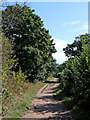
Roman Road near Norton in Stourbridge
Looking south from near Elm Close (off Clent View Road), this sandy track is also known as Sandy Lane.
The route is not actually Roman in origin. It was constructed in the 18th century as part of a turnpike (toll) road linking Kidderminster and Dudley. (information - K. James, BSc).
The course of a former Roman Road between Greensforge and Droitwich passes close by across the fields, about fifty metres off to the right (west).
Image: © Roger Kidd
Taken: 7 Aug 2020
0.15 miles
10
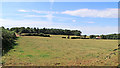
Pasture south-west of Stourbridge
Looking west-north-west from Sandy Lane (also called Roman Road ... which it is not).
The course of the actual Roman road between Droitwich and Greensforge runs along the broken hedge line at the far end of the field, and past Frog Hall Cottages on the right. The woodland on the skyline is on what was Iverley Heath, but is now part of Bunker's Hill Wood, and managed by The Woodland Trust.
Image: © Roger Kidd
Taken: 7 Aug 2020
0.15 miles