Roman Road near Norton in Stourbridge, Dudley
Introduction
The photograph on this page of Roman Road near Norton in Stourbridge, Dudley by Roger Kidd as part of the Geograph project.
The Geograph project started in 2005 with the aim of publishing, organising and preserving representative images for every square kilometre of Great Britain, Ireland and the Isle of Man.

There are currently over 7.5m images from over 14,400 individuals and you can help contribute to the project by visiting https://www.geograph.org.uk
Roman Road near Norton in Stourbridge, Dudley
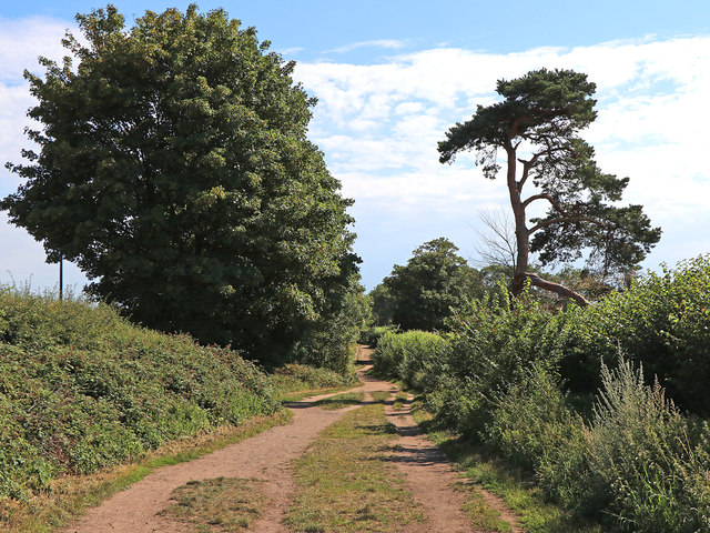
Image: © Roger Kidd Taken: 7 Aug 2020
Looking south towards Sugar Plum Lane, this sandy track is also known as Sandy Lane. The route is not actually Roman in origin. It was constructed in the 18th century as part of a turnpike (toll) road linking Kidderminster and Dudley. (information - K. James, BSc). The course of a former first century Roman Road between Droitwich and Greensforge passes very close by across the fields, off to the right (west). Beyond Sugar Plum Lane, Sandy Lane continues along the old Roman line.
Images are licensed for reuse under creativecommons.org/licenses/by-sa/2.0
Image Location
Latitude
52.443132
Longitude
-2.171349