
IMAGES TAKEN NEAR TO
Moor Street, BRIERLEY HILL, DY5 3SW
Introduction
This page details the photographs taken nearby to Moor Street, DY5 3SW by members of the Geograph project.
The Geograph project started in 2005 with the aim of publishing, organising and preserving representative images for every square kilometre of Great Britain, Ireland and the Isle of Man.

There are currently over 7.5m images from over14,400 individuals and you can help contribute to the project by visiting https://www.geograph.org.uk
Image Map
Images are licensed for reuse under creativecommons.org/licenses/by-sa/2.0
Notes
- Clicking on the map will re-center to the selected point.
- The higher the marker number, the further away the image location is from the centre of the postcode.
Image Listing (60 Images Found)
Images are licensed for reuse under creativecommons.org/licenses/by-sa/2.0
Image
Details
Distance
1

Bridge View
The view from Moor Street from the former railway bridge in Brierley Hill.
Image: © Gordon Griffiths
Taken: 16 Sep 2017
0.04 miles
2
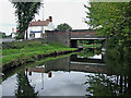
Farmer's Bridge west of Brierley Hill, Dudley
Looking north-north-west as the Stourbridge Canal meanders round Brierley Hill. Farmer's Bridge carries Moor Street. The Old Bush Fryer is renamed Moor Street Fryer in more recent images (2020)
Image: © Roger Kidd
Taken: 27 Aug 2010
0.04 miles
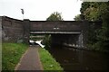
4
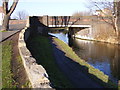
Farmers Bridge
The Stourbridge Canal goes under Moor Street and goes on to join to Dudley No 1 Canal, viewed from Addison Road.
Image: © Gordon Griffiths
Taken: 15 Jan 2012
0.04 miles
5
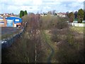
Old Railway
This is a disused railway which you can just see because it is very overgrown.The railway runs up to the Pensnett Trading estate where it finishes.
Image: © Stephen Rogerson
Taken: 12 Feb 2011
0.04 miles
6
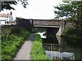
Stourbridge Canal - Farmer's Bridge
Contouring between Delph Locks and Leys Junction.
Image: © John M
Taken: 8 Aug 2009
0.05 miles
7
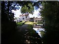
Moor Street Bridge
The view of the Stourbridge Canal at Brierley Hill.
Image: © Gordon Griffiths
Taken: 2 Sep 2017
0.05 miles
8
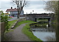
Farmer's Bridge at Brierley Hill
The bridge carries Moor Street across the Stourbridge Canal. Next to the bridge is the Moor Street Fryer, a fish and chip shop.
Image: © Mat Fascione
Taken: 22 Apr 2016
0.05 miles
9
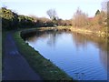
Canal Bend
The Stourbridge Canal near Moor Street.
Image: © Gordon Griffiths
Taken: 15 Jan 2012
0.06 miles
10
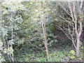
Overgrown Railway Line
The view north from Moor Street in Brierley Hill.
Image: © Gordon Griffiths
Taken: 16 Sep 2017
0.06 miles