Farmer's Bridge west of Brierley Hill, Dudley
Introduction
The photograph on this page of Farmer's Bridge west of Brierley Hill, Dudley by Roger Kidd as part of the Geograph project.
The Geograph project started in 2005 with the aim of publishing, organising and preserving representative images for every square kilometre of Great Britain, Ireland and the Isle of Man.

There are currently over 7.5m images from over 14,400 individuals and you can help contribute to the project by visiting https://www.geograph.org.uk
Farmer's Bridge west of Brierley Hill, Dudley
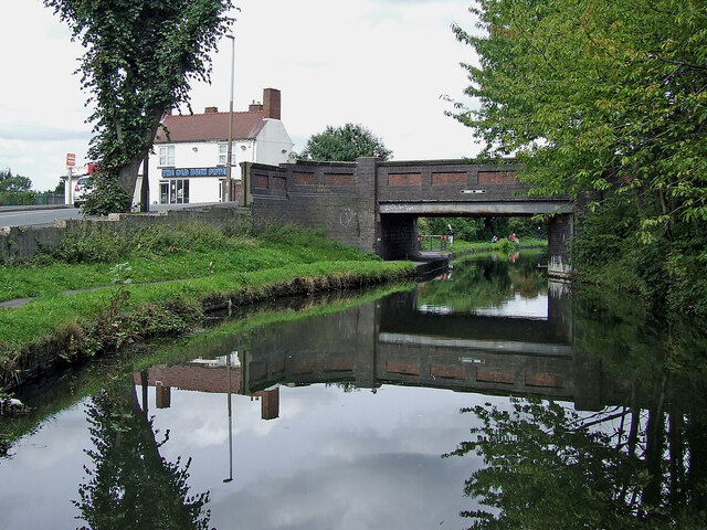
Image: © Roger Kidd Taken: 27 Aug 2010
Looking north-north-west as the Stourbridge Canal meanders round Brierley Hill. Farmer's Bridge carries Moor Street. The Old Bush Fryer is renamed Moor Street Fryer in more recent images (2020)
Images are licensed for reuse under creativecommons.org/licenses/by-sa/2.0
Image Location
Latitude
52.481835
Longitude
-2.135424