IMAGES TAKEN NEAR TO
Park Lane East, TIPTON, DY4 8RA
Introduction
This page details the photographs taken nearby to Park Lane East, DY4 8RA by members of the Geograph project.
The Geograph project started in 2005 with the aim of publishing, organising and preserving representative images for every square kilometre of Great Britain, Ireland and the Isle of Man.

There are currently over 7.5m images from over14,400 individuals and you can help contribute to the project by visiting https://www.geograph.org.uk
Image Map
Images are licensed for reuse under creativecommons.org/licenses/by-sa/2.0
Notes
- Clicking on the map will re-center to the selected point.
- The higher the marker number, the further away the image location is from the centre of the postcode.
Image Listing (67 Images Found)
Images are licensed for reuse under creativecommons.org/licenses/by-sa/2.0
Image
Details
Distance
1
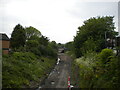
Railway trackbed, Dudley Port (2)
The former South Staffordshire line between Walsall and Dudley, looking towards Dudley from the Lower Church Lane bridge. After more than two decades of proposals, work has finally begun on using the formation for an extension to the Midland Metro light rail system, hence the clearance of vegetation and levelling of the trackbed seen here. About a quarter of a mile ahead, the formation passes beneath the Wolverhampton to Birmingham railway line, and the Birmingham Main Line Canal, adjacent to Dudley Port railway station.
Image: © Richard Vince
Taken: 29 May 2021
0.04 miles
2
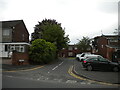
Millwright Close, Dudley Port
A residential cul de sac off Lower Church Lane.
Image: © Richard Vince
Taken: 29 May 2021
0.05 miles
3
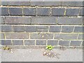
Ordnance Survey Cut Mark
This OS cut mark can be found on the NW parapet of the railway bridge on Park Lane East. It marks a point 135.511m above mean sea level.
Image: © Adrian Dust
Taken: 10 Jul 2021
0.06 miles
4
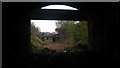
Old Dudley Port Rail
View on disused rail track, beneath the current Dudley Port station. In better times, there was two stations here - one on the main (current) Birmingham to Wolverhampton line, and another running north-east to south-west, from Walsall all the way through to Dudley and Stourbridge beyond.
The horizontal wall in the archway, is the footpath between the current Dudley Port station and main car park.
Image: © Michael Westley
Taken: 17 Apr 2017
0.08 miles
5
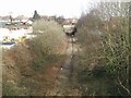
Overgrown railway at Dudley Port
The Dudley to Walsall line is currently disused but may form part of the proposed 5W's extension to the Midland Metro.
Image: © John M
Taken: 11 Mar 2007
0.08 miles
6
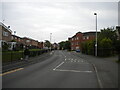
Lower Church Lane, Dudley Port
Looking towards Princes End from the junction with Keelinge Street.
Image: © Richard Vince
Taken: 29 May 2021
0.08 miles
7
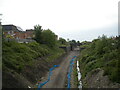
Railway trackbed, Dudley Port (1)
The former South Staffordshire line between Walsall and Dudley, looking towards Walsall from the Lower Church Lane bridge. After more than two decades of proposals, work has finally begun on using the formation for an extension to the Midland Metro light rail system, hence the clearance of vegetation and levelling of the trackbed seen here.
Image: © Richard Vince
Taken: 29 May 2021
0.09 miles
8
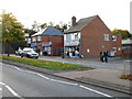
Dudley Port Fish & Chips
A venerable institution adjoining the A461 at Dudley Port station.
Image: © Peter Whatley
Taken: 22 Oct 2008
0.10 miles