Old Dudley Port Rail
Introduction
The photograph on this page of Old Dudley Port Rail by Michael Westley as part of the Geograph project.
The Geograph project started in 2005 with the aim of publishing, organising and preserving representative images for every square kilometre of Great Britain, Ireland and the Isle of Man.

There are currently over 7.5m images from over 14,400 individuals and you can help contribute to the project by visiting https://www.geograph.org.uk
Old Dudley Port Rail
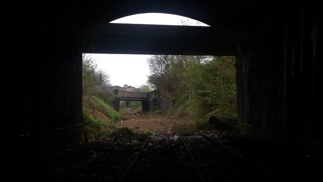
Image: © Michael Westley Taken: 17 Apr 2017
View on disused rail track, beneath the current Dudley Port station. In better times, there was two stations here - one on the main (current) Birmingham to Wolverhampton line, and another running north-east to south-west, from Walsall all the way through to Dudley and Stourbridge beyond. The horizontal wall in the archway, is the footpath between the current Dudley Port station and main car park.
Images are licensed for reuse under creativecommons.org/licenses/by-sa/2.0
Image Location
Latitude
52.525324
Longitude
-2.049628