IMAGES TAKEN NEAR TO
High Arcal Road, DUDLEY, DY3 4DB
Introduction
This page details the photographs taken nearby to High Arcal Road, DY3 4DB by members of the Geograph project.
The Geograph project started in 2005 with the aim of publishing, organising and preserving representative images for every square kilometre of Great Britain, Ireland and the Isle of Man.

There are currently over 7.5m images from over14,400 individuals and you can help contribute to the project by visiting https://www.geograph.org.uk
Image Map
Images are licensed for reuse under creativecommons.org/licenses/by-sa/2.0
Notes
- Clicking on the map will re-center to the selected point.
- The higher the marker number, the further away the image location is from the centre of the postcode.
Image Listing (17 Images Found)
Images are licensed for reuse under creativecommons.org/licenses/by-sa/2.0
Image
Details
Distance
1
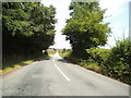
High Arcal Road View
The view just inside Staffordshire near Himley Hall.
Image: © Gordon Griffiths
Taken: 27 Jul 2013
0.06 miles
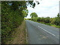
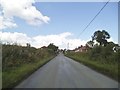
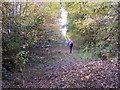
2
High Arcal Road Scene
The view of the country lane in Himley, Staffordshire.
Image: © Gordon Griffiths
Taken: 20 Sep 2022
0.11 miles
3
High Arcal Road
The view of the lane just inside Staffordshire near Himley Hall.
Image: © Gordon Griffiths
Taken: 17 Oct 2016
0.12 miles
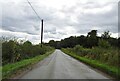
4
High Arcal Road looking north
Along the road by the side of Higharcal Wood
Image: © Richard Law
Taken: 2 Sep 2022
0.12 miles
5
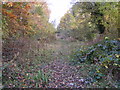
Former Railway
The view of the former railway track from Baggeridge Country Park which was the site of an old colliery. The line ran south from the Baggeridge Colliery (1899-1968) to join the former GWR railway (Wolverhampton to Stourbridge Junction Branch) near Home Farm.
Image: © Gordon Griffiths
Taken: 4 Nov 2016
0.16 miles
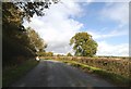
6
Gornal Approach
The view along High Arcal Road in Staffordshire near the Dudley border.
Image: © Gordon Griffiths
Taken: 25 Jul 2015
0.16 miles
7
Himley Road Bridge
The view of the bridge over old railway from Baggeridge Country Park which was the site of an old colliery. The line ran south from the Baggeridge Colliery (1899-1968) to join the former GWR railway (Wolverhampton to Stourbridge Junction Branch) near Home Farm.
Image: © Gordon Griffiths
Taken: 4 Nov 2016
0.16 miles
8
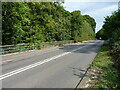
Dudley Road bridge
The bridge carries the road over the former railway line which served the coal mines & workings at what is now Baggeridge Country Park between Sedgley and Wombourne.
Image: © Richard Law
Taken: 2 Sep 2022
0.16 miles
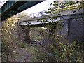
9
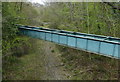
Pipebridge across a former railway trackbed
Next to the Himley Road bridge at Himley Wood.
Image: © Mat Fascione
Taken: 22 Apr 2016
0.16 miles
10
Former Railway View
The view of the former railway track from Baggeridge Country Park which was the site of an old colliery. The line ran south from the Baggeridge Colliery (1899-1968) to join the former GWR railway (Wolverhampton to Stourbridge Junction Branch) near Home Farm.
Image: © Gordon Griffiths
Taken: 4 Nov 2016
0.17 miles