
IMAGES TAKEN NEAR TO
Astley, STOURPORT-ON-SEVERN, DY13 0RR
Introduction
This page details the photographs taken nearby to DY13 0RR by members of the Geograph project.
The Geograph project started in 2005 with the aim of publishing, organising and preserving representative images for every square kilometre of Great Britain, Ireland and the Isle of Man.

There are currently over 7.5m images from over14,400 individuals and you can help contribute to the project by visiting https://www.geograph.org.uk
Image Map
Images are licensed for reuse under creativecommons.org/licenses/by-sa/2.0
Notes
- Clicking on the map will re-center to the selected point.
- The higher the marker number, the further away the image location is from the centre of the postcode.
Image Listing (8 Images Found)
Images are licensed for reuse under creativecommons.org/licenses/by-sa/2.0
Image
Details
Distance
1
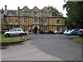
Astley Hall
Today Astley Hall is a nursing home, but formerly it was home to a British Prime Minister. Stanley Baldwin, three times British Prime Minister lived here from 1902 until his death in 1947. The house dates from the mid-19th century, the date of 1912 on the porch refers to when the house was extended. The house is Grade II listed, see: https://historicengland.org.uk/listing/the-list/list-entry/1155604
Image: © Philip Halling
Taken: 8 Sep 2018
0.13 miles
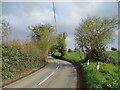
4
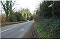
B4196 road near Astley, Worcs
In this direction this narrow winding road goes to Worcester, and offers an alternative route between Stourport-on-Severn and Worcester to the faster and probably safer A449 road, which is dual carriageway. The B4196 also serves several villages on its route.
Image: © P L Chadwick
Taken: 16 Feb 2014
0.19 miles
5
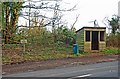
Bus shelter by the B4196 road, near Astley, Worcs
At the moment this stop gets a bus in each direction roughly every two hours on the Kidderminster & Stourport-on-Severn route to Worcester. There are no evening or Sunday services.
Image: © P L Chadwick
Taken: 16 Feb 2014
0.20 miles
6
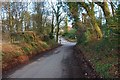
Church Lane near Astley, Worcs
Looking towards the crossroads with the B4196 Worcester to Stourport-on-Severn road and Bull Hill Lane.
Image: © P L Chadwick
Taken: 16 Feb 2014
0.21 miles
7
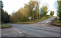
A crossroads on the B4196 road, near Astley, Worcs
Coming in on the left is Church Lane. On the right is Bull Hill (the street name plate shows this), or Bull Hill Lane, according to some maps.
Image: © P L Chadwick
Taken: 16 Feb 2014
0.21 miles
8

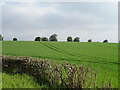
Looking southwest from the B4196 in 1987
Image: © John Baker
Taken: 10 Apr 1987
0.22 miles