
IMAGES TAKEN NEAR TO
Erneley Close, STOURPORT-ON-SEVERN, DY13 0AH
Introduction
This page details the photographs taken nearby to Erneley Close, DY13 0AH by members of the Geograph project.
The Geograph project started in 2005 with the aim of publishing, organising and preserving representative images for every square kilometre of Great Britain, Ireland and the Isle of Man.

There are currently over 7.5m images from over14,400 individuals and you can help contribute to the project by visiting https://www.geograph.org.uk
Image Map
Images are licensed for reuse under creativecommons.org/licenses/by-sa/2.0
Notes
- Clicking on the map will re-center to the selected point.
- The higher the marker number, the further away the image location is from the centre of the postcode.
Image Listing (13 Images Found)
Images are licensed for reuse under creativecommons.org/licenses/by-sa/2.0
Image
Details
Distance
1
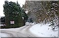
The Rough
Here the lane known as The Rough forks into two branches. The short one on the left leads to Walshes Farm Caravan Park. The one on the right is much longer, and leads to Redstone Riverside Caravan Park and Social Club.
Image
Image: © P L Chadwick
Taken: 26 Dec 2010
0.16 miles
2
Approaching the Shrawley turning, Stourport
Image: © Peter Whatley
Taken: 3 Jan 2009
0.17 miles
3
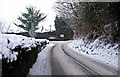
The start of The Rough
The Rough is a long lane which leads to a couple of caravan parks. Here it is near its commencement, at a junction with Dunley Road (the A451). In the distance is a fork. The left branch is quite short and leads to one of the parks. The fork on the right is much longer and leads to the other.
Image
Image: © P L Chadwick
Taken: 26 Dec 2010
0.18 miles

5
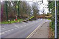
Betty Dawes Hill, Stourport-on-Severn
The road coming in on the left is called The Rough. The section of the main road ahead is called Betty Dawes Hill. It is part of the A451 road. The road on the right is Areley Lane.
Image: © P L Chadwick
Taken: 19 Feb 2012
0.21 miles
6
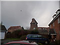
The Roundhouse, Areley Kings
A helicopter flies overhead above the old mill.
Image: © Jeremy Bolwell
Taken: 17 Dec 2012
0.21 miles
7
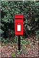
Elizabeth II post-mounted postbox, Areley Lane, Stourport-on-Severn
Located near the junction with the A451 road. See also:- Image
Postbox number:- DY13 83; post code:- DY13 O**. Last collection:- 5 pm Monday to Friday; 10.45 am Saturday.
Image: © P L Chadwick
Taken: 19 Feb 2012
0.22 miles
8

The Old Beams in winter, seen from The Rough
The Old Beams pub is seen here across the December snow. Photographed from the lane known as The Rough.
Image
Image: © P L Chadwick
Taken: 26 Dec 2010
0.23 miles
9

The Old Beams, seen from its car park, Stourport-on-Severn
A popular pub very near the river. This is one of the four surviving Stourport pubs on this side of the river, and is by far the largest, and probably the busiest, of them all. The others are towards the other end of the Areley Kings area. Image
Image: © P L Chadwick
Taken: 8 Sep 2009
0.23 miles
10

The Old Beams, Stourport-on-Severn
Public house off Dunley Road.
Image: © Mat Fascione
Taken: 12 Jun 2014
0.24 miles