
IMAGES TAKEN NEAR TO
Cornerways, The Lakes Road, BEWDLEY, DY12 2DE
Introduction
This page details the photographs taken nearby to Cornerways, The Lakes Road, DY12 2DE by members of the Geograph project.
The Geograph project started in 2005 with the aim of publishing, organising and preserving representative images for every square kilometre of Great Britain, Ireland and the Isle of Man.

There are currently over 7.5m images from over14,400 individuals and you can help contribute to the project by visiting https://www.geograph.org.uk
Image Map
Images are licensed for reuse under creativecommons.org/licenses/by-sa/2.0
Notes
- Clicking on the map will re-center to the selected point.
- The higher the marker number, the further away the image location is from the centre of the postcode.
Image Listing (20 Images Found)
Images are licensed for reuse under creativecommons.org/licenses/by-sa/2.0
Image
Details
Distance
1
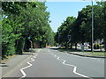
B4190 Cleobury Road, Hales Park, Bewdley
Image: © Roy Hughes
Taken: 25 Jun 2020
0.02 miles
3
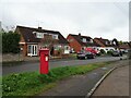
Houses on Cleobury Road, Bewdley
Showing position of Postbox No. Dy12 125.
See Image] for postbox.
Image: © JThomas
Taken: 17 Apr 2023
0.14 miles
5
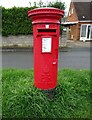
Elizabeth II postbox on Cleobury Road, Bewdley
Postbox No. DY12 125.
See Image] for context.
Image: © JThomas
Taken: 17 Apr 2023
0.14 miles
6
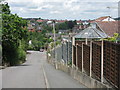
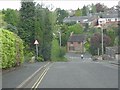
Bewdley - Merricks Lane
The fence panels show the steep slope clearly.
Image: © Peter Whatley
Taken: 14 Jul 2009
0.14 miles
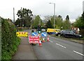
8
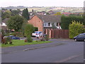
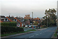
Hales Park Estate, Bewdley
1960's housing looking North across Hales Park estate towards Bark Hill estate (red rooves, right) and The Lakes Estate (centre left). On the 1940's OS Map much of this area was cherry and other fruit orchards. Now all that remain are street names of cherry varieties, Morello Close, Ironside Close, Early River Place, although it is possible to find the occasional old fruit tree in back gardens.
Image: © Richard Greenwood
Taken: 8 Oct 2006
0.16 miles
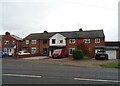
10
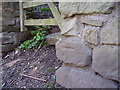
Nineteenth century benchmark on wall
This benchmark was established in 1849 during the First primary levelling of England & Wales, and was levelled with a height of 188.1030 feet [57.3338 metres] above mean sea level (Liverpool datum). It was included on the Worcester to Aberystwyth levelling line. The surveyor's description was "No. 45. Mark on stone wall at South side of road, near junction of fence ; 1.26ft. above surface" (Public Abstract p.551). The rather worn mark is easily found to the west of a small gate.
Image: © Shantavira
Taken: 23 Apr 2016
0.19 miles