
IMAGES TAKEN NEAR TO
Lower Mill Street, KIDDERMINSTER, DY11 6UT
Introduction
This page details the photographs taken nearby to Lower Mill Street, DY11 6UT by members of the Geograph project.
The Geograph project started in 2005 with the aim of publishing, organising and preserving representative images for every square kilometre of Great Britain, Ireland and the Isle of Man.

There are currently over 7.5m images from over14,400 individuals and you can help contribute to the project by visiting https://www.geograph.org.uk
Image Map
Images are licensed for reuse under creativecommons.org/licenses/by-sa/2.0
Notes
- Clicking on the map will re-center to the selected point.
- The higher the marker number, the further away the image location is from the centre of the postcode.
Image Listing (506 Images Found)
Images are licensed for reuse under creativecommons.org/licenses/by-sa/2.0
Image
Details
Distance
1
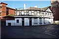
The Chapel Bar & Kitchen (1), 3 Lower Mill Street, Kidderminster, Worcs
The building here used to be occupied by Illusion Cocktail Bar until about 2016. At some point it was also known as Bridge Inn according to the Whatpub website of CAMRA (Campaign for Real Ale). The same website also says The Castle Bar & Kitchen is currently closed.
Image
Image
From September 2015:- Image
Image: © P L Chadwick
Taken: 1 Dec 2019
0.01 miles
2
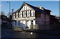
The Chapel Bar & Kitchen (2), 3 Lower Mill Street, Kidderminster, Worcs
Currently closed (December 2019) and future intentions not known.
Link to other photos:- Image
Image: © P L Chadwick
Taken: 1 Dec 2019
0.01 miles
3
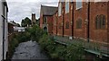
The River Stour in Kidderminster town centre
On the right is the Baxter United Reformed Church. The tower of St Mary's Church is in the distance.
Image: © Mat Fascione
Taken: 3 Aug 2020
0.01 miles
4
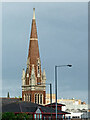
Spire of Baxter United Reform Church in Kidderminster
This telephoto view is from about 150 metres away, looking east-south-east from Lower Mill Street by the Ringway. The church dates from 1884-1885 and is Grade II listed. The spire is 140 feet (42.7 metres) high.
Image: © Roger Kidd
Taken: 13 May 2014
0.01 miles
5
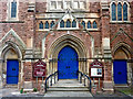
Baxter United Reformed Church in Kidderminster
This is the front entrance in the Bullring. The church dates from 1884-1885 and is Grade II listed. The spire is 140 feet (42.7 metres) high. Unfortunately, the building closed for worship on the 31st October 2021. https://sites.google.com/view/baxterurc/our-history
Image: © Roger Kidd
Taken: 13 May 2014
0.01 miles
6
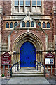
Baxter United Reformed Church in Kidderminster
This is the front entrance in the Bullring. The church dates from 1884-1885 and is Grade II listed. The spire is 140 feet (42.7 metres) high. Unfortunately, the building closed for worship on the 31st October 2021. https://sites.google.com/view/baxterurc/our-history
Image: © Roger Kidd
Taken: 13 May 2014
0.01 miles
7
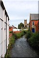
River Stour near the Bull Ring, Kidderminster
In the far distance is the tower of St. Mary & All Saints Parish Church. Image
Image: © P L Chadwick
Taken: 30 Aug 2014
0.01 miles
8
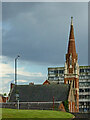
Baxter United Reform Church in Kidderminster
This teleephoto assisted view, looking south-east from the canal towpath shows the church from a distance of almost two hundred metres. The dilapidated Crown House in the Bullring (demolished 2019-2020) is beyond the church. https://www.geograph.org.uk/photo/4145754
Image: © Roger Kidd
Taken: 13 May 2014
0.01 miles
9
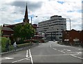
Lower Mill Street, Kidderminster
The steeple of Baxter United Reformed Church and Crown House which once housed the Inland Revenue. Crown House was recently named as one of Britain's most hated buildings.
Image: © Mat Fascione
Taken: 14 Jul 2007
0.01 miles
10
Part of Kidderminster town centre
Kiddy town centre is quite nice. It's a town that often gets slated - but I like it.
Image: © Jeremy Bolwell
Taken: 3 Sep 2014
0.01 miles