
IMAGES TAKEN NEAR TO
Stonechat Close, KIDDERMINSTER, DY10 4JF
Introduction
This page details the photographs taken nearby to Stonechat Close, DY10 4JF by members of the Geograph project.
The Geograph project started in 2005 with the aim of publishing, organising and preserving representative images for every square kilometre of Great Britain, Ireland and the Isle of Man.

There are currently over 7.5m images from over14,400 individuals and you can help contribute to the project by visiting https://www.geograph.org.uk
Image Map
Images are licensed for reuse under creativecommons.org/licenses/by-sa/2.0
Notes
- Clicking on the map will re-center to the selected point.
- The higher the marker number, the further away the image location is from the centre of the postcode.
Image Listing (38 Images Found)
Images are licensed for reuse under creativecommons.org/licenses/by-sa/2.0
Image
Details
Distance
1
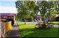
Captain's Pool Road, Spennells, Kidderminster
One of the main roads in this large residential estate. The road on the right is Lapwing Close. The house on the left has solar heating panels on its roof.
Image: © P L Chadwick
Taken: 29 Sep 2013
0.07 miles
2

Footpath off Captain's Pool Road, Spennells, Kidderminster
This footpath gives a shortcut from one loop of the road to another.
Image: © P L Chadwick
Taken: 29 Sep 2013
0.09 miles
3
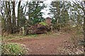
Footpath junction on edge of Spennells, Kidderminster
A path coming in from the left joins the public footpath here. The path is well-used and shown on the O.S. map but not as a public footpath. It seems however that residents of the adjacent housing estate use the path a lot, especially dog walkers.
Image: © P L Chadwick
Taken: 25 Feb 2013
0.10 miles
4
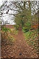
Public footpath to Stanklyn Lane, Spennells, Kidderminster
The footpath skirts the edge of Kidderminster on the right, with fields on the left. It continues with fields on both sides before reaching Stanklyn Lane.
Image: © P L Chadwick
Taken: 25 Feb 2013
0.11 miles
5
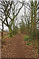
Public footpath to Stanklyn Lane, near Spennells, Kidderminster
The footpath is here clear of the boundaries of Kidderminster and is running between the trees on its way to Stanklyn Lane.
Image: © P L Chadwick
Taken: 25 Feb 2013
0.12 miles
6
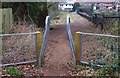
Barriers on public footpath near Captain's Pool, Spennells, Kidderminster
These are barriers to physically prevent the passage of horses on this public footpath, which is not a public bridleway. For the history of these, see:- Image
Image: © P L Chadwick
Taken: 25 Feb 2013
0.13 miles
7

Public footpath across a field, near Spennells, Kidderminster
By the hedge in the distance this path joins a public footpath running between Captain's Pool and Stanklyn Lane.
Image: © P L Chadwick
Taken: 29 Sep 2013
0.13 miles
8
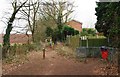
Start of the public footpath to Stanklyn Lane, Spennells, Kidderminster
The public footpath to Stanklyn Lane sets off from this point, on the edge of Kidderminster's large Spennells Housing Estate, and by Captain's Pool. Behind the public footpath waymark, is a set of barriers designed to prevent horses being ridden along the footpath, which is not a public bridleway. For more about this, please see the link below. Just by the red dog waste bin, is the start of a footpath which runs between the edge of the housing estate and the edge of Spennells Valley Nature Reserve.
Image
Image: © P L Chadwick
Taken: 25 Feb 2013
0.13 miles
9
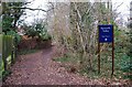
Entrance to Spennells Valley Nature Reserve, near Captain's Pool, Spennells, Kidderminster
The Nature reserve is on the right. The path runs between it and part of the Spennells Housing Estate on the left.
Image: © P L Chadwick
Taken: 25 Feb 2013
0.13 miles
10

Public footpath across a field, near Spennells, Kidderminster
The footpath joins another which leads to the Spennells housing estate. Part of this estate can be seen in the distance.
Image: © P L Chadwick
Taken: 29 Sep 2013
0.14 miles