Start of the public footpath to Stanklyn Lane, Spennells, Kidderminster
Introduction
The photograph on this page of Start of the public footpath to Stanklyn Lane, Spennells, Kidderminster by P L Chadwick as part of the Geograph project.
The Geograph project started in 2005 with the aim of publishing, organising and preserving representative images for every square kilometre of Great Britain, Ireland and the Isle of Man.

There are currently over 7.5m images from over 14,400 individuals and you can help contribute to the project by visiting https://www.geograph.org.uk
Start of the public footpath to Stanklyn Lane, Spennells, Kidderminster
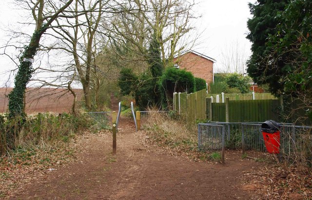
Image: © P L Chadwick Taken: 25 Feb 2013
The public footpath to Stanklyn Lane sets off from this point, on the edge of Kidderminster's large Spennells Housing Estate, and by Captain's Pool. Behind the public footpath waymark, is a set of barriers designed to prevent horses being ridden along the footpath, which is not a public bridleway. For more about this, please see the link below. Just by the red dog waste bin, is the start of a footpath which runs between the edge of the housing estate and the edge of Spennells Valley Nature Reserve. Image
Images are licensed for reuse under creativecommons.org/licenses/by-sa/2.0
Image Location
Latitude
52.371121
Longitude
-2.225121