IMAGES TAKEN NEAR TO
Quay Road, DONCASTER, DN8 4JG
Introduction
This page details the photographs taken nearby to Quay Road, DN8 4JG by members of the Geograph project.
The Geograph project started in 2005 with the aim of publishing, organising and preserving representative images for every square kilometre of Great Britain, Ireland and the Isle of Man.

There are currently over 7.5m images from over14,400 individuals and you can help contribute to the project by visiting https://www.geograph.org.uk
Image Map
Images are licensed for reuse under creativecommons.org/licenses/by-sa/2.0
Notes
- Clicking on the map will re-center to the selected point.
- The higher the marker number, the further away the image location is from the centre of the postcode.
Image Listing (8 Images Found)
Images are licensed for reuse under creativecommons.org/licenses/by-sa/2.0
Image
Details
Distance
1
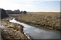
Waterside wharf
Old course of the River Don at Waterside Wharf
Image: © Richard Croft
Taken: 8 Mar 2010
0.06 miles
2
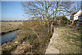
Waterside wharf
Disused wharfage at Thorne
Image: © Richard Croft
Taken: 8 Mar 2010
0.08 miles
3
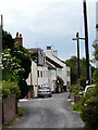
The houses at Waterside
Waterside the river Don was once used commercially at least one hundred years before the canal .. these houses show the area near the old jetty now gone ...the once river is now a swampy reed bed.
Image: © JENNY BRACK
Taken: 18 Jun 2009
0.12 miles


6
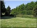
Trees and Daisies
Despite the look of this image the reality is that behind the trees is the slip road for the southbound M18 at J6. The blue 'End of Motorway' sign is just visible between the trees.
Image: © Michael Patterson
Taken: 7 Jun 2006
0.20 miles