IMAGES TAKEN NEAR TO
Langdale Drive, DONCASTER, DN5 9JG
Introduction
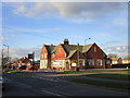
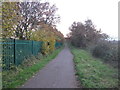
This page details the photographs taken nearby to Langdale Drive, DN5 9JG by members of the Geograph project.
The Geograph project started in 2005 with the aim of publishing, organising and preserving representative images for every square kilometre of Great Britain, Ireland and the Isle of Man.

There are currently over 7.5m images from over14,400 individuals and you can help contribute to the project by visiting https://www.geograph.org.uk
Image Map
Images are licensed for reuse under creativecommons.org/licenses/by-sa/2.0
Notes
- Clicking on the map will re-center to the selected point.
- The higher the marker number, the further away the image location is from the centre of the postcode.
Image Listing (3 Images Found)
Images are licensed for reuse under creativecommons.org/licenses/by-sa/2.0
Image
Details
Distance
2
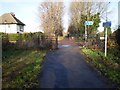
Pipering Lane Crossing
Point where the Trans Pennine Trail meets Pipering Lane and heads off right towards Bentley. The path straight ahead follows an old railway line and is part of the Doncaster Greenway.
Image: © Dave Taylor
Taken: 9 Dec 2008
0.13 miles