IMAGES TAKEN NEAR TO
Ings Lane, BRIGG, DN20 9PJ
Introduction
This page details the photographs taken nearby to Ings Lane, DN20 9PJ by members of the Geograph project.
The Geograph project started in 2005 with the aim of publishing, organising and preserving representative images for every square kilometre of Great Britain, Ireland and the Isle of Man.

There are currently over 7.5m images from over14,400 individuals and you can help contribute to the project by visiting https://www.geograph.org.uk
Image Map (Loading...)


Getting Data...Please wait
Leaflet Map data © OpenStreetMap
Images are licensed for reuse under creativecommons.org/licenses/by-sa/2.0
Notes
- Clicking on the map will re-center to the selected point.
- The higher the marker number, the further away the image location is from the centre of the postcode.
Image Listing (12 Images Found)
Images are licensed for reuse under creativecommons.org/licenses/by-sa/2.0
Image
Details
Distance
1
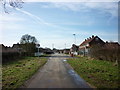
Ing's Lane
Ing's Lane, Hibaldstow. Photo taken looking towards Cherry Farm.
Image: © David Wright
Taken: 7 Jun 2006
0.08 miles
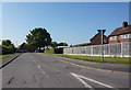
2
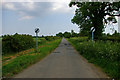
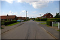
Ings Lane on the outskirts of Hibaldstow
Looking eastward. More housing planned for the fenced off area on the right will result in further growth of the village.
Image: © Peter Wood
Taken: 23 Mar 2024
0.08 miles
3
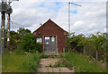
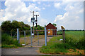
Anglian Water Building near Hibaldstow
The electricity supply suggests it is a form of Pumping Station.
Image: © Julian P Guffogg
Taken: 21 Aug 2016
0.14 miles
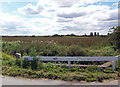
6
Anglian Water Pumping Station
Anglian Water Hibaldstow Ings Lane Pumping Station.
Image: © David Wright
Taken: 7 Jun 2006
0.16 miles
7
At the end of Ing's Lane
Photo taken at the point where Ing's Lane joins Cross Carr Road.
Image: © David Wright
Taken: 7 Aug 2007
0.17 miles
8
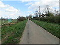
Ings Lane, Hibaldstow
Development since the 1940's has changed this part of Ings Lane into a typical suburban housing area. Picture taken from near the end of Nookings Drive looking West.
Image: © David Wright
Taken: 7 Jun 2006
0.19 miles
9
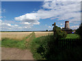
The Public Footpath to Carr Lane
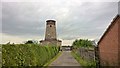
Hibaldstow Mill is on the right of the picture.
Image: © David Wright
Taken: 7 Aug 2007
0.23 miles