IMAGES TAKEN NEAR TO
Simpson Close, BARROW-UPON-HUMBER, DN19 7BL

Introduction

This page details the photographs taken nearby to Simpson Close, DN19 7BL by members of the Geograph project.

The Geograph project started in 2005 with the aim of publishing, organising and preserving representative images for every square kilometre of Great Britain, Ireland and the Isle of Man.

There are currently over 7.5m images from over14,400 individuals and you can help contribute to the project by visiting https://www.geograph.org.uk

Image Map


Images are licensed for reuse under creativecommons.org/licenses/by-sa/2.0
Notes
  • Clicking on the map will re-center to the selected point.
  • The higher the marker number, the further away the image location is from the centre of the postcode.

Image Listing (183 Images Found)

Images are licensed for reuse under creativecommons.org/licenses/by-sa/2.0
  • ...
Image
Details
Distance
1
Ivy Villas, Wold Road
Image: © Graham Hogg Taken: 16 Mar 2015
0.06 miles
2
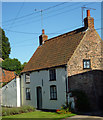
Wate Garth, Palmer Lane
This is a Grade II listed building. "House. Mid C18 with later extensions and C20 alterations. Brick, rendered to front. Pantile roof. Plan: 2-rooms with central entrance to room on left; rear outshut and kitchen extension to left. 2 storeys, 2 first floor windows. Plinth. C19 panelled door flanked by C20 4-pane casements under segmental arches. Similar first floor casements. Gutter on wooden brackets. End stacks. Tumbled-in brick to gables. Interior contains beamed ceilings. Included for group value." http://www.britishlistedbuildings.co.uk/en-165815-wate-garth-barrow-upon-humber-
Image: © David Wright Taken: 26 Aug 2013
0.07 miles
3
Wet tar on the path - keep off
As the footpath is coated with a thin tarry substance to prolong life without digging up and relaying
Image: © Chris Morgan Taken: 16 Mar 2015
0.07 miles
4
Green Lane, Barrow upon Humber
Seen from the B1206 Wold Road
Image: © Paul Harrop Taken: 5 Oct 2008
0.10 miles
5
New housing off Palmer Lane, Barrow Upon Humber
Village infill.
Image: © Jonathan Billinger Taken: 30 Aug 2013
0.10 miles
6
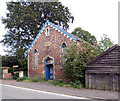
Foresters Hall
Foresters Hall, High Street. The stone above the doorway gives a date of 1864. Now looking distinctly neglected and probably ripe for conversion to residential use.
Image: © David Wright Taken: 27 Sep 2006
0.11 miles
7
Doorway - Foresters Hall
Doorway to the neglected Foresters Hall (1864) on High Street.
Image: © David Wright Taken: 27 Sep 2006
0.11 miles
8
Midby Park Entrance Gates
Entrance gates to Midby Park from the High Street. These gates appear to be permanently padlocked.
Image: © David Wright Taken: 11 Oct 2006
0.11 miles
9
Wold Road at Green Lane, Barrow
Image: © David Brown Taken: 23 Sep 2021
0.12 miles
10
Grass triangle with seat and waste bin
Where Green Lane meets Wold Road.
Image: © Jonathan Billinger Taken: 30 Aug 2013
0.13 miles
  • ...