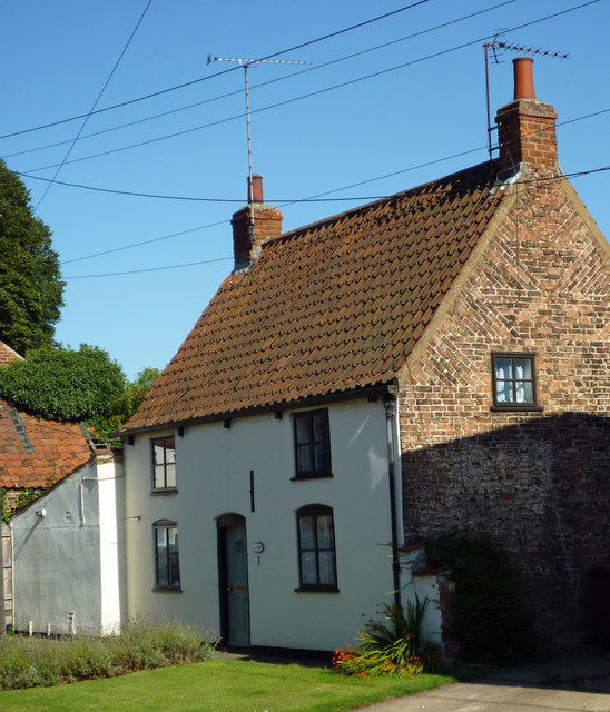
Wate Garth, Palmer Lane
Introduction
The photograph on this page of Wate Garth, Palmer Lane by David Wright as part of the Geograph project.
The Geograph project started in 2005 with the aim of publishing, organising and preserving representative images for every square kilometre of Great Britain, Ireland and the Isle of Man.
There are currently over 7.5m images from over 14,400 individuals and you can help contribute to the project by visiting https://www.geograph.org.uk

Image: © David Wright Taken: 26 Aug 2013
This is a Grade II listed building. "House. Mid C18 with later extensions and C20 alterations. Brick, rendered to front. Pantile roof. Plan: 2-rooms with central entrance to room on left; rear outshut and kitchen extension to left. 2 storeys, 2 first floor windows. Plinth. C19 panelled door flanked by C20 4-pane casements under segmental arches. Similar first floor casements. Gutter on wooden brackets. End stacks. Tumbled-in brick to gables. Interior contains beamed ceilings. Included for group value." http://www.britishlistedbuildings.co.uk/en-165815-wate-garth-barrow-upon-humber-

