
IMAGES TAKEN NEAR TO
Roberts Road, DONCASTER, DN12 1JG
Introduction
This page details the photographs taken nearby to Roberts Road, DN12 1JG by members of the Geograph project.
The Geograph project started in 2005 with the aim of publishing, organising and preserving representative images for every square kilometre of Great Britain, Ireland and the Isle of Man.

There are currently over 7.5m images from over14,400 individuals and you can help contribute to the project by visiting https://www.geograph.org.uk
Image Map
Images are licensed for reuse under creativecommons.org/licenses/by-sa/2.0
Notes
- Clicking on the map will re-center to the selected point.
- The higher the marker number, the further away the image location is from the centre of the postcode.
Image Listing (15 Images Found)
Images are licensed for reuse under creativecommons.org/licenses/by-sa/2.0
Image
Details
Distance
1
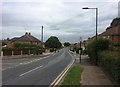
Roberts Road in New Edlington
The properties on the right back onto Edlington Wood.
Image: © Jonathan Clitheroe
Taken: 10 Jun 2017
0.04 miles
2
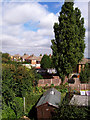
Gardens
The green enclave at the rear of Roberts Road includes useful sheds and mature trees.
Image: © Jonathan Wilkins
Taken: 25 Aug 2007
0.08 miles
3
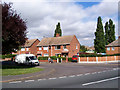
St. Mary's Road
The junction of St. Mary's Road and Roberts Road.
Image: © Jonathan Wilkins
Taken: 25 Aug 2007
0.11 miles
4
Housing clearance New Edlington Doncaster
On Roberts Road.
Image: © Steve Fareham
Taken: 5 Aug 2008
0.12 miles
5
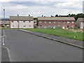
Miners Housing
These houses would have been built to accommodate the local coal miners from one of the many collieries that were once in this area.
Image: © Michael Patterson
Taken: 7 Sep 2006
0.13 miles
6
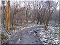
Edlington Wood
One of the many informal paths through this ancient woodland, which has yew, chestnut, beech, oak and birch trees as well as invasive sycamore. The location is impossible to photograph in Summer due to the thick canopy of leaves.
Image: © Jonathan Wilkins
Taken: 19 Feb 2010
0.14 miles
7
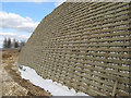
Crib wall
The bare rock face exposed in the terracing work is being stabilised and landscaped with a timber crib wall. See Image for the view of what is behind the wall.
"A timber crib retaining system is a cellular mass-gravity retaining wall.
The finished structure’s inherent weight and collective mass allows it to retain the target material without being destabilized. It is constructed using individual sections of interlocking pressure treated timber to form a framework which is then filled with aggregate during assembly to add weight and stability to the structure". Thanks to TCRS Ltd. for that explanation.
Image: © Jonathan Wilkins
Taken: 31 Mar 2013
0.16 miles
8
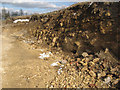
Rock outcrop
A temporary exposure of the dolostone of the Cadeby Formation (Permian, 250 million years old) on the development of Yew Gardens. It is quite a surprise to find that rock is so close to the surface, although the steep slope above the Don Valley migh be expected to have thin soils. The slope is being cut back here to make a terrace, and rock which is being produced is crushed on site along with demolition waste for use in other areas. See Image for the view of how the rock-face will be stabilised and finished.
Image: © Jonathan Wilkins
Taken: 31 Mar 2013
0.16 miles
9
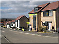
New houses, Stubbins Hill
Part of the Yew Gardens development of environmentally-sound houses.
Image: © Jonathan Wilkins
Taken: 31 Mar 2013
0.16 miles
10
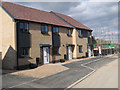
New housing, Granby Road
Newly-completed houses alongside others still in build. The whole development is known as Yew Gardens, but whether the old road names will be retained is unknown. Geography is a bit hazy here at present!
Image: © Jonathan Wilkins
Taken: 31 Mar 2013
0.18 miles