Rock outcrop
Introduction
The photograph on this page of Rock outcrop by Jonathan Wilkins as part of the Geograph project.
The Geograph project started in 2005 with the aim of publishing, organising and preserving representative images for every square kilometre of Great Britain, Ireland and the Isle of Man.

There are currently over 7.5m images from over 14,400 individuals and you can help contribute to the project by visiting https://www.geograph.org.uk
Rock outcrop
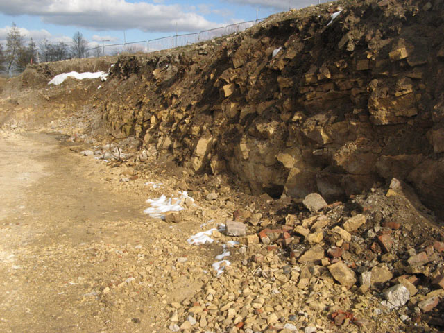
Image: © Jonathan Wilkins Taken: 31 Mar 2013
A temporary exposure of the dolostone of the Cadeby Formation (Permian, 250 million years old) on the development of Yew Gardens. It is quite a surprise to find that rock is so close to the surface, although the steep slope above the Don Valley migh be expected to have thin soils. The slope is being cut back here to make a terrace, and rock which is being produced is crushed on site along with demolition waste for use in other areas. See Image for the view of how the rock-face will be stabilised and finished.
Images are licensed for reuse under creativecommons.org/licenses/by-sa/2.0
Image Location
Latitude
53.481167
Longitude
-1.185806