
IMAGES TAKEN NEAR TO
Lydgate Crescent, BISHOP AUCKLAND, DL13 3LE
Introduction
This page details the photographs taken nearby to Lydgate Crescent, DL13 3LE by members of the Geograph project.
The Geograph project started in 2005 with the aim of publishing, organising and preserving representative images for every square kilometre of Great Britain, Ireland and the Isle of Man.

There are currently over 7.5m images from over14,400 individuals and you can help contribute to the project by visiting https://www.geograph.org.uk
Image Map
Images are licensed for reuse under creativecommons.org/licenses/by-sa/2.0
Notes
- Clicking on the map will re-center to the selected point.
- The higher the marker number, the further away the image location is from the centre of the postcode.
Image Listing (90 Images Found)
Images are licensed for reuse under creativecommons.org/licenses/by-sa/2.0
Image
Details
Distance
3
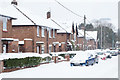
Icicles on houses on Lister Terrace East
Lister Terrace East is a residential street on the eastern side of Wolsingham.
Image: © Trevor Littlewood
Taken: 1 Mar 2018
0.05 miles
4
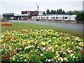
Robsons of Wolsingham
Business on the main road east of Waskerley Bridge selling caravans and motor homes.
Image: © Andrew Curtis
Taken: 2 Sep 2011
0.06 miles
5
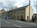
Terraced housing on Durham Road, Wolsingham
Image: © JThomas
Taken: 24 Aug 2017
0.08 miles
6
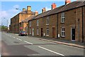
Fronts of Houses on Durham Road
With the office building of the ironworks beyond.
Image: © Mick Garratt
Taken: 29 May 2012
0.09 miles
7
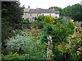
Terrace off Silver Street, Wolsingham
Taken from the west rise of the Waskerley Bridge.
Image: © Andrew Curtis
Taken: 2 Sep 2011
0.10 miles
8
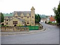
East End, Wolsingham
Photo taken from the west end of the bridge over the Waskerley Beck. East End is the main road through Weardale (A689). The grand building on the left was formerly the Parish Hall and associated buildings recently converted for residential use.
Image: © Andrew Curtis
Taken: 2 Sep 2011
0.11 miles
9
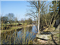
River Wear with large stone block
The large block of dressed stone appears to have been placed there but it's more likely that it has simply been discarded - there's a number of other, similar stones, some significantly larger, lying haphazardly alongside the path above the river in this vicinity. Presumably the blocks have come from the site of the disused Wolsingham Steelworks which lies to the right out of the image. Some of the metal fencing securing the site can be seen at the edge of the frame.
Image: © Trevor Littlewood
Taken: 27 Mar 2020
0.12 miles
10
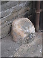
Old Bridge Marker on the A689 in Wolsingham
County Bridge Marker on the north side of the A689 west of Waskerley Bridge, Waskerley Beck. Wolsingham parish. Inscribed C. The stone marks the extent of roadway adjoining the bridge that Durham County was obliged to maintain.
Milestone Society National ID: DU_WOL01br
Image: © Mike Rayner
Taken: 17 Feb 2019
0.12 miles