
IMAGES TAKEN NEAR TO
Palmer Road, STANLEY, DH9 9HY
Introduction
This page details the photographs taken nearby to Palmer Road, DH9 9HY by members of the Geograph project.
The Geograph project started in 2005 with the aim of publishing, organising and preserving representative images for every square kilometre of Great Britain, Ireland and the Isle of Man.

There are currently over 7.5m images from over14,400 individuals and you can help contribute to the project by visiting https://www.geograph.org.uk
Image Map
Images are licensed for reuse under creativecommons.org/licenses/by-sa/2.0
Notes
- Clicking on the map will re-center to the selected point.
- The higher the marker number, the further away the image location is from the centre of the postcode.
Image Listing (24 Images Found)
Images are licensed for reuse under creativecommons.org/licenses/by-sa/2.0
Image
Details
Distance
1
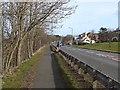
Front Street, Dipton
The footway along the busy A692 has been designated for shared use by pedestrians and cyclists.
Image: © Oliver Dixon
Taken: 28 Feb 2014
0.11 miles
2
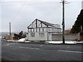
Former Co-op store
This building on Flint Hill Bank at Dipton used to be the local Co-op grocery store. Now it's a private dwelling.
Image: © Robert Graham
Taken: 27 Mar 2013
0.12 miles
3
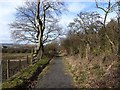
Footpath from Flint Hill to Dipton
It seems very possible that this footpath follows the track of an old mineral railway.
Image: © Oliver Dixon
Taken: 28 Feb 2014
0.13 miles
4

Rear view of former farmhouse
This used to be the farmyard of Boundary House Farm at Flint Hill. This old farm ceased to be a working farm in the late 20th century when a housing estate was built around it. The farmhouse itself survives as a private dwelling, as can be seen.
Image: © Robert Graham
Taken: 6 Mar 2023
0.13 miles
5

Boundary House Farm
This house is on North Road, Dipton. The name comes the fact that this point was the boundary between two medieval commons; Lanchester and Tanfield. Although the farmhouse has been much modified, it probably dates back to the 19th century. It was still a working farm in the 1960's but is no longer.
Image: © Robert Graham
Taken: 9 Apr 2014
0.13 miles
6
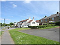
Italian restaurant, Dipton
On Front Street, Hilltop. This used to be a pub and has been put to a good use, many village pubs have been demolished or converted to private dwellings. I think it used to be The Grey Horse.
Image: © Robert Graham
Taken: 6 Jun 2014
0.13 miles
7

Boundary House, Flint Hill
This house on North Road takes its name from the fact that back in the C18, this was the boundary between Lanchester and Tanfield Commons.
Image: © Robert Graham
Taken: 30 Nov 2016
0.14 miles
8
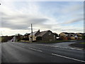
Former farm at Flint Hill
On North Road. All that remains of the farm is the former farmhouse.
Image: © Robert Graham
Taken: 30 Nov 2016
0.14 miles
9
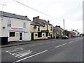
North Road, Flint Hill
This is on the eastern side of Dipton village. The pub called The Flint Hill Inn is commonly called "The Jerry" by all the locals. I believe the name Jerry originally was used for a pub which sold only beer.
Image: © Robert Graham
Taken: 9 Apr 2014
0.15 miles
10
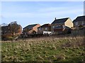
An outbreak of decking at Lily Gardens, Flint Hill
Image: © Oliver Dixon
Taken: 28 Feb 2014
0.17 miles