IMAGES TAKEN NEAR TO
Edmundbyers, CONSETT, DH8 9NG
Introduction
This page details the photographs taken nearby to DH8 9NG by members of the Geograph project.
The Geograph project started in 2005 with the aim of publishing, organising and preserving representative images for every square kilometre of Great Britain, Ireland and the Isle of Man.

There are currently over 7.5m images from over14,400 individuals and you can help contribute to the project by visiting https://www.geograph.org.uk
Image Map
Images are licensed for reuse under creativecommons.org/licenses/by-sa/2.0
Notes
- Clicking on the map will re-center to the selected point.
- The higher the marker number, the further away the image location is from the centre of the postcode.
Image Listing (69 Images Found)
Images are licensed for reuse under creativecommons.org/licenses/by-sa/2.0
Image
Details
Distance
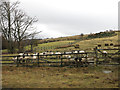
1
Muggleswick : The Burnside
Looking towards a B&B.
Image: © Lewis Clarke
Taken: 25 Sep 2020
0.01 miles
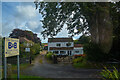
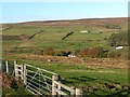
2
Burnside
Burnside is the property among the trees below the foreground field; it's situated close to the Burnhope Burn and offers bed and breakfast as well as holiday cottages to let.
Image: © Trevor Littlewood
Taken: 4 Nov 2021
0.01 miles
3
Burnside Bed and Breakfast
Great location by Burnhope Burn and next to moorland.
Image: © Hugh Venables
Taken: 17 Mar 2013
0.01 miles
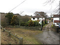
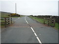
4
Muggleswick : B6278
Heading along the B6278.
Image: © Lewis Clarke
Taken: 25 Sep 2020
0.02 miles
5
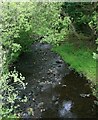
Burnhope Burn
Looking downstream from the bridge at Burnside.
Image: © Paul Franks
Taken: 22 May 2022
0.03 miles
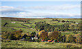
7
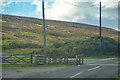
View back down to the Stanhope road
Looking down from the Muggleswick road south of Edmundbyers to the B6278, the road to Stanhope. On the horizon can be seen the start of the moors of Ruffside Moor, above Limerick Cottage farm.
Image: © Robert Graham
Taken: 21 Oct 2019
0.03 miles
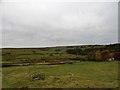
8
The valley of the Burnhope Burn
A lorry can be seen descending the B6278 out of Edmundbyers to cross the burn before the ascent to Park Head. Limerick Cottage Image can be seen on the far hillside.
Image: © Oliver Dixon
Taken: 1 Nov 2013
0.04 miles
9
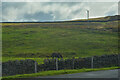
Muggleswick : Grassy Field
A field off the road.
Image: © Lewis Clarke
Taken: 25 Sep 2020
0.05 miles