
IMAGES TAKEN NEAR TO
CONSETT, DH8 9EZ
Introduction
This page details the photographs taken nearby to DH8 9EZ by members of the Geograph project.
The Geograph project started in 2005 with the aim of publishing, organising and preserving representative images for every square kilometre of Great Britain, Ireland and the Isle of Man.

There are currently over 7.5m images from over14,400 individuals and you can help contribute to the project by visiting https://www.geograph.org.uk
Image Map
Images are licensed for reuse under creativecommons.org/licenses/by-sa/2.0
Notes
- Clicking on the map will re-center to the selected point.
- The higher the marker number, the further away the image location is from the centre of the postcode.
Image Listing (19 Images Found)
Images are licensed for reuse under creativecommons.org/licenses/by-sa/2.0
Image
Details
Distance
1
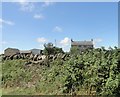
View of Woodlands Park Farm
Looking west from Butsfield Lane. A farmstead established in the C20, rather surprisingly. It looks older but probably dates from the 1930's. It must have been deliberately built in a traditional style.
Image: © Robert Graham
Taken: 23 Jul 2019
0.01 miles
2
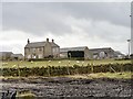
Woodlands Park Farm
This farm stands near the junction of the minor road from Knitsley with Longedge Lane, south of Consett. It takes its name from the near bye Woodlands Park estate. Although it looks traditional, it's not that old. It is not shown on the 1923 Ordnance Survey map, so must be later than that. From the look of it, I would guess 1930's. The farmhouse must have been deliberately built in a C19 style.
Image: © Robert Graham
Taken: 25 Feb 2015
0.01 miles
3

Woodlands Park Farm
The course of a Roman Aqueduct went this way.
Image: © Russel Wills
Taken: 14 Aug 2025
0.03 miles
4
Looking North from Longedge Lane
Looking across to Woodlands Park Farm.
Image: © Robert Graham
Taken: 11 Mar 2012
0.06 miles
5

Unpromising footpath
The stone stile is buried under brambles!
Image: © Russel Wills
Taken: 14 Aug 2025
0.12 miles
6
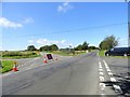
Five ways junction on Longedge Lane
This junction sees Longedge Lane crossed here by the road coming from the left from Knitsley. There is also another road on the left called Eliza Lane which runs SW to the A68.
Image: © Robert Graham
Taken: 23 Jul 2019
0.15 miles
7
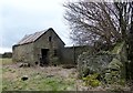
Old outbuilding at David's Town
This ruined farmstead stands beside the minor road south from Knitsley to Longedge Lane. This old byer must have continued in use after the farm was abandoned because it's been re-roofed at some stage. On the right is the remains of an earth closet outhouse.
Image: © Robert Graham
Taken: 25 Feb 2015
0.15 miles
8
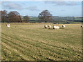
Pasture at David's Town
This field is remarkable for a Roman aqueduct which previously crossed it on the way to the fort at Lanchester. Better eyesight than mine is required to spot any remains on the ground. "David's Town" is actually behind the wall in the distance: a strange semi circular field enclosure.
Image: © David Collins
Taken: 17 Feb 2007
0.16 miles
10

Sheep in meadow at David's Town
Collapsed dry stone walls fixed by gates seems unethical. But cheap!
Image: © Russel Wills
Taken: 14 Aug 2025
0.16 miles