Old outbuilding at David's Town
Introduction
The photograph on this page of Old outbuilding at David's Town by Robert Graham as part of the Geograph project.
The Geograph project started in 2005 with the aim of publishing, organising and preserving representative images for every square kilometre of Great Britain, Ireland and the Isle of Man.

There are currently over 7.5m images from over 14,400 individuals and you can help contribute to the project by visiting https://www.geograph.org.uk
Old outbuilding at David's Town
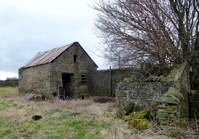
Image: © Robert Graham Taken: 25 Feb 2015
This ruined farmstead stands beside the minor road south from Knitsley to Longedge Lane. This old byer must have continued in use after the farm was abandoned because it's been re-roofed at some stage. On the right is the remains of an earth closet outhouse.
Images are licensed for reuse under creativecommons.org/licenses/by-sa/2.0
Image Location
Latitude
54.81978
Longitude
-1.816486