IMAGES TAKEN NEAR TO
Castleside, CONSETT, DH8 9AP
Introduction
This page details the photographs taken nearby to DH8 9AP by members of the Geograph project.
The Geograph project started in 2005 with the aim of publishing, organising and preserving representative images for every square kilometre of Great Britain, Ireland and the Isle of Man.

There are currently over 7.5m images from over14,400 individuals and you can help contribute to the project by visiting https://www.geograph.org.uk
Image Map
Images are licensed for reuse under creativecommons.org/licenses/by-sa/2.0
Notes
- Clicking on the map will re-center to the selected point.
- The higher the marker number, the further away the image location is from the centre of the postcode.
Image Listing (97 Images Found)
Images are licensed for reuse under creativecommons.org/licenses/by-sa/2.0
Image
Details
Distance
1
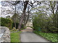
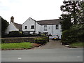
Entrance to Castleside Vicarage
Leads off Church Street, leading up to Healeyfield Lane on the western side of the village.
Image: © Robert Graham
Taken: 8 May 2015
0.03 miles
2
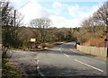
Lower end of Church Street, Castleside
The road here goes up the bank on the other side and joins Healeyfield Lane. This is the main route westwards from the village to Stanhope and Weardale. The track on the left was once the entrance to the lead smelting works, closed shortly after WW2 I believe.
Image: © Robert Graham
Taken: 16 Mar 2020
0.04 miles
4
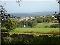
Looking down Church Street
This is the country road leading into Castleside village from the west, coming from Stanhope in Weardale. This was the original part of the village before the 19th century expansion took place beside the modern A68, although nothing much remains here.
Image: © Robert Graham
Taken: 16 Mar 2020
0.05 miles
5
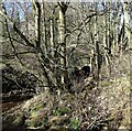
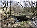
Conduit for Watergate Burn
The little burn runs under Church Street in Castleside through the conduit here.
Image: © Robert Graham
Taken: 14 Mar 2022
0.05 miles
6
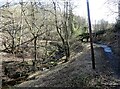
Path beside Watergate Burn
The path here leads from Dean Howl Farm to Church Street in Castleside.
Image: © Robert Graham
Taken: 14 Mar 2022
0.06 miles
7
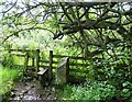
Stile beside the burn
This is at the end of a field path leading across from Healeyfield Lane to Church Street in Castleside. Watergate Burn is just to the right. From the old stone post, there must have been a gate opening here at one time.
Image: © Robert Graham
Taken: 23 Aug 2021
0.07 miles
8
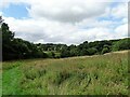
Picnic site at Castleside
This area beside the Watergate Burn, on the east side of Church Street, has been restored from a derelict industrial site.
Image: © Robert Graham
Taken: 23 Aug 2021
0.07 miles
9
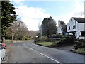
Rose Cottage, Castleside
Nice whitewashed cottage on Church Street, opposite the vicarage. This lane leads out of the village to the west.
Image: © Robert Graham
Taken: 8 May 2015
0.07 miles
10
The Watergate Burn in Castleside
Pictured in early spring close to where it flows under Church Street. This little stream runs along the western edge of the village.
Image: © Robert Graham
Taken: 16 Mar 2020
0.08 miles