
IMAGES TAKEN NEAR TO
Hazelwood Court, DURHAM, DH7 9FY
Introduction
This page details the photographs taken nearby to Hazelwood Court, DH7 9FY by members of the Geograph project.
The Geograph project started in 2005 with the aim of publishing, organising and preserving representative images for every square kilometre of Great Britain, Ireland and the Isle of Man.

There are currently over 7.5m images from over14,400 individuals and you can help contribute to the project by visiting https://www.geograph.org.uk
Image Map
Images are licensed for reuse under creativecommons.org/licenses/by-sa/2.0
Notes
- Clicking on the map will re-center to the selected point.
- The higher the marker number, the further away the image location is from the centre of the postcode.
Image Listing (26 Images Found)
Images are licensed for reuse under creativecommons.org/licenses/by-sa/2.0
Image
Details
Distance
1
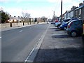
Low Moor Road
Looking East to the village centre.
Image: © David Clark
Taken: 1 Apr 2010
0.08 miles
2

All Saints Church, Langley Park
The brick-built church of All Saints lies in the middle of the old 'pit village' of Langley Park. The prominent grave in the foreground records the deaths of several members of a family of which two sons were killed in WWI. The two iron cross grave markers are for young children.
Image: © Trevor Littlewood
Taken: 4 May 2010
0.08 miles
3
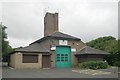
Langley Park old fire station
Langley Park old fire station, rear of Church Street, Langley Park, County Durham
Image: © Kevin Hale
Taken: 3 Aug 2010
0.09 miles
4
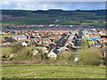
Langley Park
Viewed from Hill Top, looking north
Image: © Oliver Dixon
Taken: 3 Apr 2006
0.15 miles
5
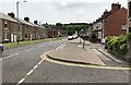
Front Street
Looking South along Front Street.
Image: © Chris Thomas-Atkin
Taken: 23 Jun 2018
0.15 miles
6
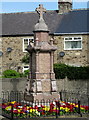
Langley Park War Memorial
A monument mainly in polished granite (?) standing at the main road junction in this old coal mining village of NW. Durham.
Image: © Trevor Littlewood
Taken: 4 May 2010
0.15 miles
7
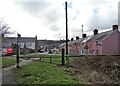
Old terraced Streets at Langley Park
Some of the original Victorian terraces from the late 19th century founding of the mining village. The one on the right is Dale Street. Pictured from the Lanchester Valley Railway Walk, which runs along the north side of the village.
Image: © Robert Graham
Taken: 21 Feb 2022
0.15 miles
8
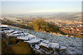
Langley Park
Taken opposite the New Board Inn at Hill Top
Image: © John Street
Taken: 31 Jan 2006
0.16 miles
9

St Andrews Methodist Church
Front Street, Langley Park.
'Our church aims to worship God and share his love with the local community.'
https://www.durhamlocate.org.uk/Services/1455/St-Andrew-s-Methodis
Image: © Russel Wills
Taken: 23 May 2025
0.16 miles
10
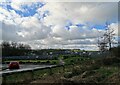
West end of Langley Park
View south from the Lanchester Valley Walk, the former railway which runs alongside the village. On the horizon can be seen the old agricultural village of Esh.
Image: © Robert Graham
Taken: 21 Feb 2022
0.16 miles