IMAGES TAKEN NEAR TO
Kirbys Drive, DURHAM, DH6 5GA
Introduction
This page details the photographs taken nearby to Kirbys Drive, DH6 5GA by members of the Geograph project.
The Geograph project started in 2005 with the aim of publishing, organising and preserving representative images for every square kilometre of Great Britain, Ireland and the Isle of Man.

There are currently over 7.5m images from over14,400 individuals and you can help contribute to the project by visiting https://www.geograph.org.uk
Image Map
Images are licensed for reuse under creativecommons.org/licenses/by-sa/2.0
Notes
- Clicking on the map will re-center to the selected point.
- The higher the marker number, the further away the image location is from the centre of the postcode.
Image Listing (16 Images Found)
Images are licensed for reuse under creativecommons.org/licenses/by-sa/2.0
Image
Details
Distance
2
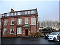
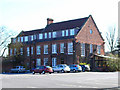
Bowburn Hall Hotel
This was built in about 1920 for Bell Brothers, a company which owned ironworks and the local collieries. It was then called Bowburn Grange and was the home of the colliery agent. After the pits closed in the 1960's, it was sold and converted into a hotel.
Image: © Robert Graham
Taken: 10 Dec 2012
0.10 miles
3
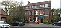
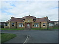
Bowburn Hall Hotel
Formerly known as Bowburn Grange.
Image: © Colin Kinnear
Taken: 12 Nov 2021
0.10 miles
5
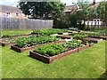
Vegetable Garden
Vegetables in raised beds
Image: © David Robinson
Taken: 26 Jun 2014
0.13 miles
6
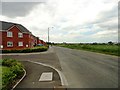
View along Tail Upon End Road
This wonderfully named lane runs along the northern edge of Bowburn village, south of Durham. Although flanked by a modern housing estate, it is of much older origin and is shown on the first O D map from the 1860's.
Image: © Robert Graham
Taken: 19 Jun 2013
0.15 miles
7
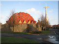
Church of Christ the King, Bowburn
Built in 1976, this striking futuristic church stood in the former mining village of Bowburn. Unfortunately, it suffered serious design faults and was closed in September 2004. At the time of photography the building was in a sorry state with the roof in a poor state of repair, and the whole premises fortified like Fort Knox against vandals. The building was demolished in May 2007, just leaving the cross standing.
Image: © Oliver Dixon
Taken: 11 Jan 2007
0.17 miles
8
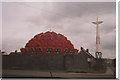
The Church of Christ the King, Bowburn in 1992
Known locally as the 'Pineapple Church'
Image: © Peter Robinson
Taken: Unknown
0.18 miles
9
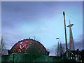
Bowburn church
An interesting and very striking building but a flawed design and it was sadly demolished after standing empty for several years.
Image: © Helen Wilkinson
Taken: 13 Dec 2005
0.19 miles