
IMAGES TAKEN NEAR TO
St. Marys Terrace, DURHAM, DH6 4JB
Introduction
This page details the photographs taken nearby to St. Marys Terrace, DH6 4JB by members of the Geograph project.
The Geograph project started in 2005 with the aim of publishing, organising and preserving representative images for every square kilometre of Great Britain, Ireland and the Isle of Man.

There are currently over 7.5m images from over14,400 individuals and you can help contribute to the project by visiting https://www.geograph.org.uk
Image Map
Images are licensed for reuse under creativecommons.org/licenses/by-sa/2.0
Notes
- Clicking on the map will re-center to the selected point.
- The higher the marker number, the further away the image location is from the centre of the postcode.
Image Listing (10 Images Found)
Images are licensed for reuse under creativecommons.org/licenses/by-sa/2.0
Image
Details
Distance
2
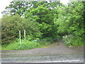
Bridleway from Roman Road in Parkhill to Old Quarrington
Image: © Peter Robinson
Taken: 10 Jun 2012
0.12 miles
4
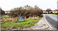
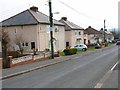
Two routes approaching Parkhill
Parkhill is a small village lying between Coxhoe and junction 61 on the A1M; it isn't named on OS maps. To the right is the B6291 which passes through the settlement; to the left is a byway, rather overgrown, which goes partly along its western side. The blue and yellow road sign is in a style commonly seen in County Durham.
Image: © Trevor Littlewood
Taken: 19 Nov 2019
0.16 miles
6
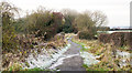
Bridleway approaching Parkhill
The route ahead once past the hedges will enter a belt of woodland before reaching the small settlement of Parkhill at the B6291.
Image: © Trevor Littlewood
Taken: 19 Nov 2019
0.22 miles
8
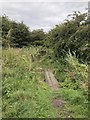
Footpath,Coxhoe
Footpath crossing boggy ground beside the course of the old railway / waggonway that served the first Bowburn Colliery, then the lime works at Coxhoe.
Image: © David Robinson
Taken: 27 Aug 2018
0.23 miles
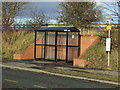
10
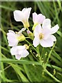
Cuckooflower
Cardamine pratensis, commonly called Cuckooflower or Lady's Smock. The County Flower of Cheshire as assigned by Plantlife in their 2002 County Flowers campaign.
Image: © David Robinson
Taken: 6 Jun 2023
0.25 miles