Two routes approaching Parkhill
Introduction
The photograph on this page of Two routes approaching Parkhill by Trevor Littlewood as part of the Geograph project.
The Geograph project started in 2005 with the aim of publishing, organising and preserving representative images for every square kilometre of Great Britain, Ireland and the Isle of Man.

There are currently over 7.5m images from over 14,400 individuals and you can help contribute to the project by visiting https://www.geograph.org.uk
Two routes approaching Parkhill
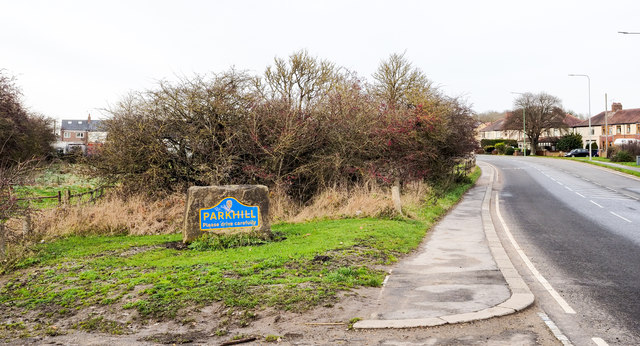
Image: © Trevor Littlewood Taken: 19 Nov 2019
Parkhill is a small village lying between Coxhoe and junction 61 on the A1M; it isn't named on OS maps. To the right is the B6291 which passes through the settlement; to the left is a byway, rather overgrown, which goes partly along its western side. The blue and yellow road sign is in a style commonly seen in County Durham.
Images are licensed for reuse under creativecommons.org/licenses/by-sa/2.0
Image Location
Latitude
54.722689
Longitude
-1.511229