
IMAGES TAKEN NEAR TO
Stonebridge, DURHAM, DH1 4TF
Introduction
This page details the photographs taken nearby to DH1 4TF by members of the Geograph project.
The Geograph project started in 2005 with the aim of publishing, organising and preserving representative images for every square kilometre of Great Britain, Ireland and the Isle of Man.

There are currently over 7.5m images from over14,400 individuals and you can help contribute to the project by visiting https://www.geograph.org.uk
Image Map
Images are licensed for reuse under creativecommons.org/licenses/by-sa/2.0
Notes
- Clicking on the map will re-center to the selected point.
- The higher the marker number, the further away the image location is from the centre of the postcode.
Image Listing (10 Images Found)
Images are licensed for reuse under creativecommons.org/licenses/by-sa/2.0
Image
Details
Distance
2
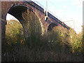
Relly Mill Viaduct
Where the East Coast main line crosses the deep valley of the River Browney, just to the south-west of Durham city. The viaduct stands over the original Relly Mill. Underneath the far arch of the viaduct is the remains of the abutment of the original wooden viaduct of the Bishop Auckland Branch (additional information supplied by Craig Oliphant).
Image: © Oliver Dixon
Taken: 18 Feb 2006
0.11 miles
3
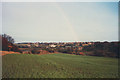
Field above Stonebridge
The crop field slopes down to the River Browney; in the distance the river is crossed by a railway viaduct.
Image: © Stephen Craven
Taken: 15 Dec 1982
0.11 miles
5
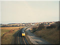
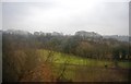
Railway near Neville's Cross
This view of the railway was taken from the B6302 road bridge before electrification around 1990. Aerial photographs show that since it was taken, part of the fields to the left (west) of the line have been planted with trees. In the distance, to the right of the picture, is the viaduct over the River Browney Image
Image: © Stephen Craven
Taken: 15 Dec 1982
0.12 miles
6
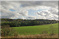
View east from East Coast Main Line
Across the field are trees along the River Browney.
Image: © Robin Webster
Taken: 18 Oct 2019
0.13 miles
7
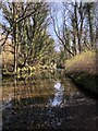
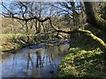
River Browney near Relly Mill Viaduct
Image: © David Robinson
Taken: 27 Mar 2022
0.15 miles
8
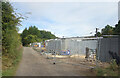
Work Site by the Railway
Contractors are doing something by the railway which is over on the right. The only access to their site is along another railway line, long closed and now a footpath/cycleway.
Image: © Des Blenkinsopp
Taken: 23 Aug 2022
0.15 miles
9
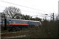
The East Coast Main Railway Line by Broompark
The Lanchester Valley Walk footpath from Langley Park to the Broom Park Picnic Area passes yards from the East Coast main railway line at one spot. A GNER train thunders by.
Image: © Uncredited
Taken: 16 Mar 2005
0.19 miles
10
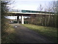
Lanchester Valley Walk
The Walk passes under Broom Lane next to the railway.
Image: © Gordon Griffiths
Taken: 14 Mar 2008
0.24 miles