Railway near Neville's Cross
Introduction
The photograph on this page of Railway near Neville's Cross by Stephen Craven as part of the Geograph project.
The Geograph project started in 2005 with the aim of publishing, organising and preserving representative images for every square kilometre of Great Britain, Ireland and the Isle of Man.

There are currently over 7.5m images from over 14,400 individuals and you can help contribute to the project by visiting https://www.geograph.org.uk
Railway near Neville's Cross
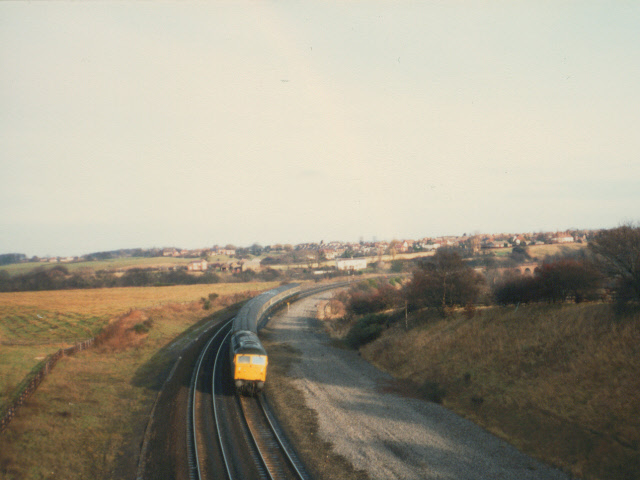
Image: © Stephen Craven Taken: 15 Dec 1982
This view of the railway was taken from the B6302 road bridge before electrification around 1990. Aerial photographs show that since it was taken, part of the fields to the left (west) of the line have been planted with trees. In the distance, to the right of the picture, is the viaduct over the River Browney Image
Images are licensed for reuse under creativecommons.org/licenses/by-sa/2.0
Image Location
Latitude
54.770662
Longitude
-1.605779