
IMAGES TAKEN NEAR TO
Dovedale Avenue, DERBY, DE24 0QB
Introduction
This page details the photographs taken nearby to Dovedale Avenue, DE24 0QB by members of the Geograph project.
The Geograph project started in 2005 with the aim of publishing, organising and preserving representative images for every square kilometre of Great Britain, Ireland and the Isle of Man.

There are currently over 7.5m images from over14,400 individuals and you can help contribute to the project by visiting https://www.geograph.org.uk
Image Map
Images are licensed for reuse under creativecommons.org/licenses/by-sa/2.0
Notes
- Clicking on the map will re-center to the selected point.
- The higher the marker number, the further away the image location is from the centre of the postcode.
Image Listing (11 Images Found)
Images are licensed for reuse under creativecommons.org/licenses/by-sa/2.0
Image
Details
Distance
1
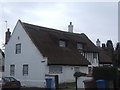
Church Farm, Church Street, Alvaston
This thatched cottage is one of a group of old buildings tucked away in a quiet corner of Alvaston.
Image: © Derek Wosik
Taken: 12 Mar 2007
0.04 miles
2
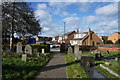
Looking away from the church
The church of St. Michael's and All Angels is behind the photographer in this image which looks out across the edge of the graveyard towards Alvaston Street.
Image: © Malcolm Neal
Taken: 12 Feb 2020
0.06 miles
3
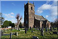
St. Michael's and All Angels Church
This is the parish church of the original village of Alvaston. The village is now a suburb of Derby and has changed hugely since the church was built.
Image: © Malcolm Neal
Taken: 12 Feb 2020
0.09 miles
4
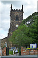
St. Michael's and All Angels
Alvaston parish church. The bells were ringing a peel for Evensong.
...far away, across the fields, the tolling of the iron bell, calls the faithful to their knees, to hear the softly spoken magic spell... - Roger Waters.
Is what was running through my head.
Image: © David Lally
Taken: 11 Aug 2013
0.09 miles
5
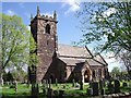
St Michael and All Angels' Church
There has been a church in Alvaston since Saxon times. The current building is 19th century.
Image: © Ian Calderwood
Taken: 12 May 2012
0.10 miles
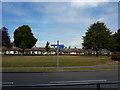
7
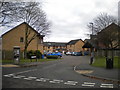
Castleton Court, Alvaston
Off Branksome Avenue, giving access to housing that replaced Image There were five blocks of flats here, named after places on the Isle of Wight. This road was called Durley Close before the flats were demolished.
Image: © Richard Vince
Taken: 7 Dec 2019
0.15 miles
9
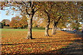
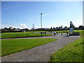
The National Field on Elvaston Lane, Alvaston, Derby
The National Field is a recreation ground and part of a parcel of land gifted to the people of Alvaston and Boulton by the Earl of Harrington of Elvaston Castle.
Part of the conveyance document reads "given by the Earl of Harrington to the Archdeacon of Derby, to be used as and for a school for the education of children and adults or children only of the labouring manufacturing and other poorer classes in the townships of Alvaston and Boulton and as a residence for the teacher or teachers of the said school and for no other purpose."
Image: © John Blaylock
Taken: 6 Nov 2011
0.17 miles
10
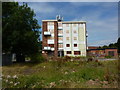
Boarded up flats
Elvaston Lane; a similar block appears to have been demolished.
Image: © Peter Barr
Taken: 26 Jul 2011
0.21 miles