
IMAGES TAKEN NEAR TO
Avon Crescent, DUNDEE, DD5 3TX
Introduction
This page details the photographs taken nearby to Avon Crescent, DD5 3TX by members of the Geograph project.
The Geograph project started in 2005 with the aim of publishing, organising and preserving representative images for every square kilometre of Great Britain, Ireland and the Isle of Man.

There are currently over 7.5m images from over14,400 individuals and you can help contribute to the project by visiting https://www.geograph.org.uk
Image Map
Images are licensed for reuse under creativecommons.org/licenses/by-sa/2.0
Notes
- Clicking on the map will re-center to the selected point.
- The higher the marker number, the further away the image location is from the centre of the postcode.
Image Listing (25 Images Found)
Images are licensed for reuse under creativecommons.org/licenses/by-sa/2.0
Image
Details
Distance
1
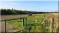
A92
The A92 is now a dual carriageway, but here it is on two levels so the westbound carriageway is out of sight. Broughty Ferry has jumped over the road into the green belt and the field on the right is probably in danger of development.
Image: © Richard Webb
Taken: 27 Sep 2014
0.10 miles
2
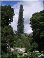
A 'mast' see!!!!
As we were walking along the Dighty Burn, my niece asked me to spot the mobile phone mast ~ can you? It is certainly more aesthetically pleasing than most of the masts in the local area.
Image: © Gwen and James Anderson
Taken: 26 Jun 2007
0.10 miles
3
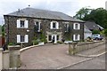
Eriboll on Panmurefield Road
With grounds running down to Dighty Water.
Image: © Russel Wills
Taken: 17 Jun 2018
0.13 miles
4
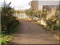
Bridge over burn near the Seven Arches
This ancient stone bridge sits at the edge of a modern housing estate.
Image: © Douglas Nelson
Taken: 27 Nov 2012
0.15 miles
5
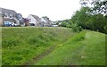
Remnant of an old mill lade above the Dighty Water
The Dighty Water was a hard worked stream in the days of water power.
New housing has replaced the bleachfield that was around here.
Image: © Russel Wills
Taken: 17 Jun 2018
0.15 miles
6
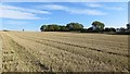
Stubble, Roman Hill
A harvested field above the A92.
Image: © Richard Webb
Taken: 27 Sep 2014
0.16 miles
7
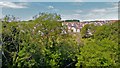
Monifieth housing
A newish housing development seen from the Seven Arches viaduct.
Image: © AlastairG
Taken: 8 Jul 2014
0.16 miles
8
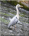
Heron on a weir
On Dighty Water near Balmossie Mill.
Image: © Russel Wills
Taken: 17 Jun 2018
0.17 miles
9
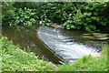
Weir on the Dighty Water
The Dighty powered many mills on its way from the Sidlaw hills to Monifieth sands.
Note the heron waiting for lunch!
Image: © Russel Wills
Taken: 17 Jun 2018
0.17 miles
10
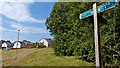
Monifieth path network
New houses beside one of the paths in an extensive network of foot and cycle paths in the area.
Image: © AlastairG
Taken: 8 Jul 2014
0.18 miles