
IMAGES TAKEN NEAR TO
Kinneff, MONTROSE, DD10 0TH
Introduction
This page details the photographs taken nearby to DD10 0TH by members of the Geograph project.
The Geograph project started in 2005 with the aim of publishing, organising and preserving representative images for every square kilometre of Great Britain, Ireland and the Isle of Man.

There are currently over 7.5m images from over14,400 individuals and you can help contribute to the project by visiting https://www.geograph.org.uk
Image Map
Images are licensed for reuse under creativecommons.org/licenses/by-sa/2.0
Notes
- Clicking on the map will re-center to the selected point.
- The higher the marker number, the further away the image location is from the centre of the postcode.
Image Listing (5 Images Found)
Images are licensed for reuse under creativecommons.org/licenses/by-sa/2.0
Image
Details
Distance
1
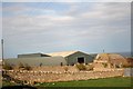
Hallhill Farm
A farm overlooking the sea by Todhead.
Image: © Andrew Wood
Taken: 14 Apr 2011
0.05 miles
2
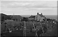
Hallhill farm
A fine variety of chickens, geese and ducks occupy the slightly ramshackle enclosures in the foreground.
Image: © Bill Harrison
Taken: 23 Mar 2019
0.08 miles
3
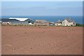
Hallhill Farm
Another farm which seems to hang between the land and the sea, with wonderful views along the coast.
Image: © Anne Burgess
Taken: 13 May 2008
0.08 miles
4
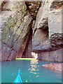
E entrance to a through cave at Powdam
Shows the sun shining through the S entrance. See Image Navigable near high tide with a very low swell. The S tunnel is narrow and the W wall leans E.
Image: © Nigel Feilden
Taken: 27 Feb 2021
0.21 miles
5
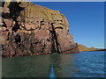
S entrance to a through cave at Powdam
The tall triangle in line with the kayak bow is the S entrance to a cave which turns right and out on the far side. Only navigable at high tide and very low swell. Powdam is round the corner and left.
Image: © Nigel Feilden
Taken: 27 Feb 2021
0.22 miles