S entrance to a through cave at Powdam
Introduction
The photograph on this page of S entrance to a through cave at Powdam by Nigel Feilden as part of the Geograph project.
The Geograph project started in 2005 with the aim of publishing, organising and preserving representative images for every square kilometre of Great Britain, Ireland and the Isle of Man.

There are currently over 7.5m images from over 14,400 individuals and you can help contribute to the project by visiting https://www.geograph.org.uk
S entrance to a through cave at Powdam
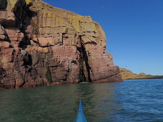
Image: © Nigel Feilden Taken: 27 Feb 2021
The tall triangle in line with the kayak bow is the S entrance to a cave which turns right and out on the far side. Only navigable at high tide and very low swell. Powdam is round the corner and left.
Images are licensed for reuse under creativecommons.org/licenses/by-sa/2.0
Image Location
Latitude
56.875503
Longitude
-2.221974