
IMAGES TAKEN NEAR TO
Sandpiper Close, GREENHITHE, DA9 9RY
Introduction
This page details the photographs taken nearby to Sandpiper Close, DA9 9RY by members of the Geograph project.
The Geograph project started in 2005 with the aim of publishing, organising and preserving representative images for every square kilometre of Great Britain, Ireland and the Isle of Man.

There are currently over 7.5m images from over14,400 individuals and you can help contribute to the project by visiting https://www.geograph.org.uk
Image Map
Images are licensed for reuse under creativecommons.org/licenses/by-sa/2.0
Notes
- Clicking on the map will re-center to the selected point.
- The higher the marker number, the further away the image location is from the centre of the postcode.
Image Listing (41 Images Found)
Images are licensed for reuse under creativecommons.org/licenses/by-sa/2.0
Image
Details
Distance
1
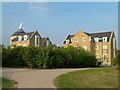
Waterstone Park Oast House
As part of the Waterstone Park design to integrate into the landscape a modern 'Fake' Oast has been added. Running Parallel to the London Road, vehicle access is only from Sanderling Way. Ramblers can take the scenic route via the old road Image
Image: © Ken Brown
Taken: 27 Jul 2008
0.04 miles
2
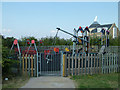
Waterstone Park Playground
Up the hill from Sandpiper Close Image is a purpose built playpark and grassed playing field which overlooks river views to the north and the new Fusion development to the south. It can be only be accessed by foot from either the London road Image or Waterstone Park.
Image: © Ken Brown
Taken: 28 Jul 2008
0.05 miles
4
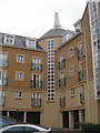
23-28 Sanderling Way
Central staircase with an oast house inspired cowl on top.
Image: © Oast House Archive
Taken: 12 Aug 2011
0.06 miles
5
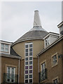
23-28 Sanderling Way
Central staircase with an oast house inspired cowl on top.
Image: © Oast House Archive
Taken: 12 Aug 2011
0.06 miles
6
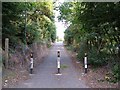
Old (unnamed) road to Stone Castle
This road leads from London Road, Greenhithe, by foot to the new development 'Fusion' on Waterstone Park, and then loops back round overlooking the Bluewater Complex Image past Stone Castle Image and then back to the London Road.
Image: © Ken Brown
Taken: 27 Jul 2008
0.07 miles
7
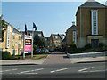
Waterstone Park, Emergency Access
By foot or in emergencies this is the easiest access to Waterstone Park. Off the A226 London Road by the Waterstone Park bus stop it saves going around the estate and over the multitude of speed bumps.
Image: © Ken Brown
Taken: 28 Jul 2008
0.08 miles
9
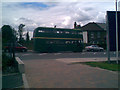
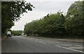
Greenline Bus
Greenline Bus going past Kingfisher Drive down the London Road, Greenhithe, Kent
Image: © Ken Brown
Taken: 13 Jul 2008
0.10 miles
10
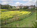
Looking towards London Road, Greenhithe
Viewed from Bean Road and looking towards London Road, both busy roads because of their proximity to Bluewater. In fact, although it seems a long way out of London, red London buses can be regularly seen here on their way to and from the shopping centre. The area on the left has, as at 2014, been cleared for a housing development.
Image: © Marathon
Taken: 12 Apr 2011
0.11 miles