
IMAGES TAKEN NEAR TO
Hartley Road, WELLING, DA16 1BB
Introduction
This page details the photographs taken nearby to Hartley Road, DA16 1BB by members of the Geograph project.
The Geograph project started in 2005 with the aim of publishing, organising and preserving representative images for every square kilometre of Great Britain, Ireland and the Isle of Man.

There are currently over 7.5m images from over14,400 individuals and you can help contribute to the project by visiting https://www.geograph.org.uk
Image Map
Images are licensed for reuse under creativecommons.org/licenses/by-sa/2.0
Notes
- Clicking on the map will re-center to the selected point.
- The higher the marker number, the further away the image location is from the centre of the postcode.
Image Listing (45 Images Found)
Images are licensed for reuse under creativecommons.org/licenses/by-sa/2.0
Image
Details
Distance
1
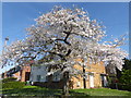
Blossom seen from Lodge Hill
This is on the corner of Lodge Hill and Denton Road.
Image: © Marathon
Taken: 24 Mar 2020
0.13 miles
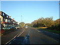
3
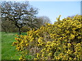
Gorse on Bostall Heath
This photograph is taken within a small triangle of Bostall Heath at its southern end and separated by West Heath Road from the main part of Bostall Heath. The road alongside here is Longleigh Lane.
Image: © Marathon
Taken: 9 Apr 2015
0.17 miles
4
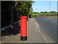
The top of Lodge Hill
The Borough boundary follows Lodge Hill. I am standing in the Royal Borough of Greenwich and the London Borough of Bexley is on the other side of the road. Ahead ,beyond Longleigh Lane, is Clam Field which is part of Bostall Heath.
The railings on the left belong to Goldie Leigh Hospital. For a history of this site and more information on its present usage see http://ezitis.myzen.co.uk/goldieleigh.html and http://www.workhouses.org.uk/Woolwich/
Image: © Marathon
Taken: 27 Oct 2014
0.17 miles
5
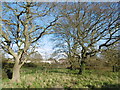
On Bostall Heath
This photograph is taken of the small triangle of Bostall Heath at its southern end and separated by West Heath Road from the main part of Bostall Heath. The road alongside here is Longleigh Lane and the houses in the distance are in Brampton Road.
Image: © Marathon
Taken: 11 Feb 2016
0.18 miles
6
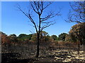
Fire damage on Bostall Heath
This was another baking hot day during the summer of 2022 when it had been the driest period since records began in 1836. Fires on open land were a regular occurrence. This is West Heath which is part of Bostall Heath.
Image: © Marathon
Taken: 12 Aug 2022
0.18 miles
7
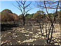
Fire damage on Bostall Heath
This was another baking hot day during the summer of 2022 when it had been the driest period since records began in 1836. Fires on open land were a regular occurrence. This is West Heath which is part of Bostall Heath.
Image: © Marathon
Taken: 12 Aug 2022
0.19 miles
8
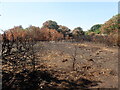
Fire damage on Bostall Heath
This was another baking hot day during the summer of 2022 when it had been the driest period since records began in 1836. Fires on open land were a regular occurrence. This is West Heath which is part of Bostall Heath.
Image: © Marathon
Taken: 12 Aug 2022
0.19 miles
9
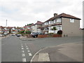
Totnes Road, East Wickham
Houses on Totnes Road, a residential road in the outer suburbs of south east London.
Image: © Malc McDonald
Taken: 14 Jul 2019
0.19 miles
10
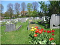
Plumstead Cemetery and Goldie Leigh
The site now occupied by Plumstead Cemetery was formerly parkland that was laid out during the 17th century. The land was owned by Old Park Farm in 1845. Plumstead Cemetery was opened by Woolwich Burial Board in 1890. It occupies a prominent hillside and is backed to the north by Bostall Woods.
For much more detail about the cemetery see http://www.londongardensonline.org.uk/gardens-online-record.asp?ID=GRN040
Beyond the fence is the Goldie Leigh site. For more of the interesting history of Goldie Leigh see http://ezitis.myzen.co.uk/goldieleigh.html and http://www.workhouses.org.uk/Woolwich/
Image: © Marathon
Taken: 20 Apr 2015
0.19 miles