IMAGES TAKEN NEAR TO
Sandown Road, GRAVESEND, DA12 5EN
Introduction
This page details the photographs taken nearby to Sandown Road, DA12 5EN by members of the Geograph project.
The Geograph project started in 2005 with the aim of publishing, organising and preserving representative images for every square kilometre of Great Britain, Ireland and the Isle of Man.

There are currently over 7.5m images from over14,400 individuals and you can help contribute to the project by visiting https://www.geograph.org.uk
Image Map
Images are licensed for reuse under creativecommons.org/licenses/by-sa/2.0
Notes
- Clicking on the map will re-center to the selected point.
- The higher the marker number, the further away the image location is from the centre of the postcode.
Image Listing (16 Images Found)
Images are licensed for reuse under creativecommons.org/licenses/by-sa/2.0
Image
Details
Distance
1
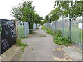
London Countryway in Kent (18)
The walk continues along the path and through barriers.
Image: © Shazz
Taken: 10 Jul 2016
0.06 miles
2
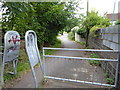
London Countryway in Kent (19)
This is the last barrier on the way to Hever Court Road.
Image: © Shazz
Taken: 10 Jul 2016
0.09 miles
3
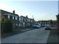
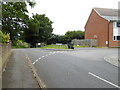
Footpath to "King's Farm"
This urban footpath runs north From Watling St towards the King’s Farm area of Gravesend
Image: © Glyn Baker
Taken: 2 Apr 2006
0.10 miles
4
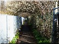
London Countryway in Kent (20)
Instead of going straight ahead over Hever Court Road the walk takes this mysterious detour via Epsom Close and onto the path on the left of the image.
Image: © Shazz
Taken: 10 Jul 2016
0.12 miles
7
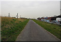
Roman Road, Singlewell
Only a footpath. In the nineteenth century, the Watling Street here was only a byway, and disappeared altogether around Swanscombe. Between Dartford and Rochester, turnpikes took London-Dover traffic along the shore through Greenhithe and Gravesend.
Image: © Dylan Moore
Taken: 23 Mar 2016
0.16 miles
8
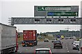
Exit to Gravesend East
Marling cross junction
Image: © John Salmon
Taken: 21 Jul 2009
0.18 miles
9
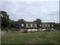
Premier Inn, Gravesend
This motel is beside Hever Road.
It was beside the A2 road. Where the trees are in the foreground. It is now beside a cyclepath/footpath on the old roman road.
Image: © David Anstiss
Taken: 30 Sep 2012
0.18 miles