1
Middlewich Road (A530), N Nantwich
Broad road on the outskirts of Nantwich. The recreational grounds at The Barony are on the right, St Mary's Cemetery and the retail park on Beam Heath Way are on the left
Image: © Espresso Addict
Taken: 9 Oct 2006
0.02 miles
2
Path along the edge of the Barony
The path is part of National Cycle Network route 451.
Image: © DS Pugh
Taken: 6 Aug 2023
0.05 miles
3
The Barony
Looking across playing fields from part of National Cycle Network route 451.
Image: © DS Pugh
Taken: 6 Aug 2023
0.06 miles
4
Angel at St Mary's Cemetery
This angel is one of the most striking monuments of St Mary's Cemetery. It stands near the south-west boundary; the line of willows is in Barony Park on the far side of the Middlewich Road
Image: © Espresso Addict
Taken: 9 Oct 2006
0.08 miles
5
Leafy path at St Mary's Cemetery
The older of two cemeteries in Nantwich, St Mary's is shaded by many mature trees. View south west towards the Middlewich Road gate
Image: © Espresso Addict
Taken: 9 Oct 2006
0.08 miles
6
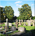
St Mary's Cemetery, N Nantwich
The older of two cemeteries in Nantwich, St Mary's has graves dating from the late 1840s. According to the groundsman, the cemetery was formerly known as Fingerpost Field, and it was opened to cope with cholera epidemics of the 1840s. This view is towards the eastern boundary
Image: © Espresso Addict
Taken: 9 Oct 2006
0.08 miles
7
Recreational ground at The Barony
Northern end of a large recreational ground north east of the town centre; it straddles the boundary with
Image
Image: © Espresso Addict
Taken: 9 Oct 2006
0.08 miles
8
Hurleston Buildings
Looking along a street leading to Barony Road in Nantwich.
Image: © DS Pugh
Taken: 6 Aug 2023
0.08 miles
9
Sunlight through the trees, St Mary's Cemetery
This is the eastern edge of the cemetery, looking towards the gateway at the Barony Road and Middlewich Road junction
Image: © Espresso Addict
Taken: 9 Oct 2006
0.09 miles
10
Weaver Road
Looking along Weaver Road in Nantwich on a wet day.
Image: © DS Pugh
Taken: 6 Aug 2023
0.10 miles


