
IMAGES TAKEN NEAR TO
Bessancourt, CREWE, CW4 7AN
Introduction
This page details the photographs taken nearby to Bessancourt, CW4 7AN by members of the Geograph project.
The Geograph project started in 2005 with the aim of publishing, organising and preserving representative images for every square kilometre of Great Britain, Ireland and the Isle of Man.

There are currently over 7.5m images from over14,400 individuals and you can help contribute to the project by visiting https://www.geograph.org.uk
Image Map
Images are licensed for reuse under creativecommons.org/licenses/by-sa/2.0
Notes
- Clicking on the map will re-center to the selected point.
- The higher the marker number, the further away the image location is from the centre of the postcode.
Image Listing (72 Images Found)
Images are licensed for reuse under creativecommons.org/licenses/by-sa/2.0
Image
Details
Distance
1
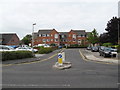
Holmes Chapel - Parkway
Parkway's name is more appropriate now than when constructed, since its contemporary purpose is to provide access for car parking both public and private. The latter serves the McCarthy and Stone retirement flats prominent in this view. The flats replaced a former restaurant which had been derelict for some years.
Image: © Peter Whatley
Taken: 28 Aug 2008
0.06 miles
2
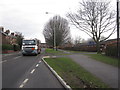
B5308 Middlewich Road, Holmes Chapel
Leading to the M6 junction from Holmes Chapel centre this B-road carries a heavy load of traffic and with no special restrictions outside the primary school here.
Image: © Peter Turner
Taken: 21 Feb 2012
0.06 miles
3
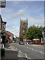
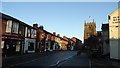
Holmes Chapel, church tower
Looking up London Road towards the tower of St. Luke's Parish Church, at the junction with Knutsford Road. http://www.imagesofengland.org.uk/Details/Default.aspx?id=406436&mode=adv
Image: © Mike Faherty
Taken: 1 Sep 2009
0.07 miles
5
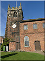
St Luke's, Holmes Chapel - tower
The sandstone tower dates from c.1430 and contains six bells. The lozenge shaped clock dials on the north and south sides are unusual.
Image: © Stephen Craven
Taken: 23 Feb 2019
0.08 miles
7
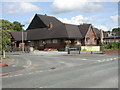
Holmes Chapel, George & Dragon
Pub at the junction of Middlewich and Knutsford Roads. Internally, L-shaped bar, drinking & eating areas on three sides. Cask ales on offer at my visit: Robinson's Hatters, Old Stockport, Tit for Tat, Unicorn.
Image: © Mike Faherty
Taken: 1 Sep 2009
0.08 miles
8
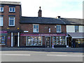
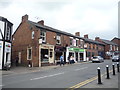
Shops on London Road, Holmes Chapel
The centre of Holmes Chapel (or Church Hulme as it was then called) suffered a great fire in 1753 that destroyed many buildings including those on this site. They were rebuilt later in the century; the building that now houses Gascoigne Halman, Estate Agents bears the date 1798 and the initials TBH (Thomas Bayley Hall of the Hermitage, who paid for most of the rebuilding).
Image: © Stephen Craven
Taken: 23 Feb 2019
0.08 miles
9
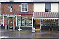
Shops in Holmes Chapel
The weather hasn't improved much in twelve years and the butcher's shop has remained substantially the same. The estate agent's has changed its name, however. Compare with Image
Image: © Stephen McKay
Taken: 27 Nov 2019
0.08 miles
10
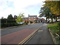
Urban road heading towards the centre of Holmes Chapel
Image: © James Denham
Taken: 22 Sep 2011
0.08 miles