St Luke's, Holmes Chapel - tower
Introduction
The photograph on this page of St Luke's, Holmes Chapel - tower by Stephen Craven as part of the Geograph project.
The Geograph project started in 2005 with the aim of publishing, organising and preserving representative images for every square kilometre of Great Britain, Ireland and the Isle of Man.

There are currently over 7.5m images from over 14,400 individuals and you can help contribute to the project by visiting https://www.geograph.org.uk
St Luke's, Holmes Chapel - tower
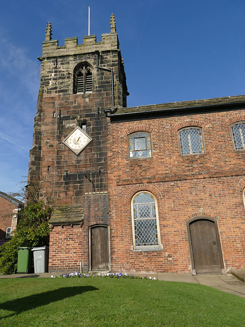
Image: © Stephen Craven Taken: 23 Feb 2019
The sandstone tower dates from c.1430 and contains six bells. The lozenge shaped clock dials on the north and south sides are unusual.
Images are licensed for reuse under creativecommons.org/licenses/by-sa/2.0
Image Location
Latitude
53.201966
Longitude
-2.357752