
IMAGES TAKEN NEAR TO
Queens Park Drive, CREWE, CW2 7SA
Introduction
This page details the photographs taken nearby to Queens Park Drive, CW2 7SA by members of the Geograph project.
The Geograph project started in 2005 with the aim of publishing, organising and preserving representative images for every square kilometre of Great Britain, Ireland and the Isle of Man.

There are currently over 7.5m images from over14,400 individuals and you can help contribute to the project by visiting https://www.geograph.org.uk
Image Map
Images are licensed for reuse under creativecommons.org/licenses/by-sa/2.0
Notes
- Clicking on the map will re-center to the selected point.
- The higher the marker number, the further away the image location is from the centre of the postcode.
Image Listing (69 Images Found)
Images are licensed for reuse under creativecommons.org/licenses/by-sa/2.0
Image
Details
Distance
1
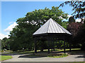
Queen's Park: Charles Dick memorial shelter
A plaque explains that it is in memory of Charles Dick, works manager of the LNWR (the railway company that was responsible for the town's existence) who died in 1888, the year the park was opened.
Image: © Stephen Craven
Taken: 19 Jul 2015
0.04 miles
2
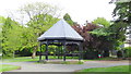
Shelter, reconditioned approx 2006
This shelter was erected in memory of Charles Dick JP 1838 - 1888.
He was manager of London North Western Railway works at Crewe from 1882 until his death in 1888.
He was also Deputy Mayor of Crewe in 1887.
Image: © Garry Lavender-Rimmer
Taken: 24 May 2015
0.04 miles
3
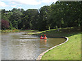
Queen's Park: lake, east end
The lake is about 325m long, and occupies most of the southern side of the park. seen here is one of the dragon boats (a form of pedalo).
Image: © Stephen Craven
Taken: 19 Jul 2015
0.05 miles
4

Queen's Park lake, Crewe
On a frosty October morning. The restoration of the park is still ongoing but at least the lake has water and wildfowl again.
Image: © Margaret Sutton
Taken: 25 Oct 2010
0.05 miles
5
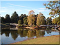
Bridges over the lake in Queen's Park
The bridges are recent replacements, so recent you still have to admire them from afar.
Image: © Margaret Sutton
Taken: 25 Oct 2010
0.05 miles
6
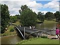
Queen's Park: lake, south bridge
The lake is about 325m long, and occupies most of the southern side of the park. Seen here is the bridge connecting the central island to the south bank.
Image: © Stephen Craven
Taken: 19 Jul 2015
0.07 miles
7
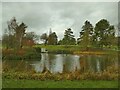
Queen's Park - east end of the lake
The lake is about 325m long, and occupies most of the southern side of the park. Compare this midwinter view with a summer one Image
Image: © Stephen Craven
Taken: 30 Dec 2022
0.07 miles
8

Public Footpath
Photograph taken from Alton street showing the footpath known locally as both "The Black Path" or "The Ravine"
Image: © Garry Lavender-Rimmer
Taken: 26 May 2015
0.08 miles
9
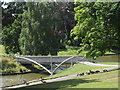
Queen's Park: lake, north bridge
The lake is about 325m long, and occupies most of the southern side of the park. Seen here is the bridge connecting the central island to the north bank.
Image: © Stephen Craven
Taken: 19 Jul 2015
0.09 miles
10
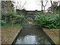
Queen's Park - lake outfall
The park lake was formed from damming the Valley Brook; the outfall drops over a weir, and resumes its course as it flows under Queen's Park Drive.
Image: © Stephen Craven
Taken: 30 Dec 2022
0.09 miles