
IMAGES TAKEN NEAR TO
Bedford Street, CREWE, CW2 6LE
Introduction
This page details the photographs taken nearby to Bedford Street, CW2 6LE by members of the Geograph project.
The Geograph project started in 2005 with the aim of publishing, organising and preserving representative images for every square kilometre of Great Britain, Ireland and the Isle of Man.

There are currently over 7.5m images from over14,400 individuals and you can help contribute to the project by visiting https://www.geograph.org.uk
Image Map
Images are licensed for reuse under creativecommons.org/licenses/by-sa/2.0
Notes
- Clicking on the map will re-center to the selected point.
- The higher the marker number, the further away the image location is from the centre of the postcode.
Image Listing (44 Images Found)
Images are licensed for reuse under creativecommons.org/licenses/by-sa/2.0
Image
Details
Distance
1
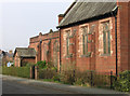
Crewe - St Andrews Church
On Bedford Street. For an alternative view, please see Image
Image: © Dave Bevis
Taken: 4 Mar 2013
0.02 miles
2
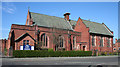
Church of St Andrew, Bedford Street, Crewe
Large red-brick parish church on Bedford Street; founded in 1922 and rebuilt in 1932. The central 'tower' houses two small bells. A small garden lies to the east (right) but there is no cemetery
Image: © Espresso Addict
Taken: 4 Apr 2007
0.02 miles
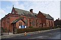
4
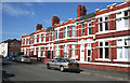
Terraced houses, Sherwin Street, Crewe
Red-brick Victorian/Edwardian terrace on a quiet residential street south of Nantwich Road. The castellated bay windows and scroll decoration above the doors make it more ornate than many in this area. The doorway on one example (not visible) retains the original porch with decorative half-tiling
Image: © Espresso Addict
Taken: 4 Apr 2007
0.07 miles
5
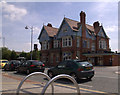
Another one bites the dust
This is the proposed site for a new ALDI supermarket.
Suggested modifications to the ALDI artists impression can be seen here:
http://www.flickr.com/photos/grotspot/3603466439/
Image: © Terry Hughes
Taken: Unknown
0.10 miles

8
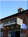
British Transport Police building on Pedley Street, Crewe (Cheshire)
View of British Transport Police building on Pedley Street, Crewe (Cheshire), seen from the Royal Hotel building. This was, apparently, once a school building. Its future is uncertain as the redevelopment of Crewe station could see police and car parking housed within the new central unit...
Image: © Crewe blog
Taken: 23 Mar 2007
0.11 miles
9
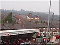
Alexandra ward, seen from the Gresty Road ground
Alexandra ward of Crewe, seen from the main stand of Crewe Alexandra's Gresty Road ground. Nantwich Road in the immediate background, with Delamere House (town centre) in the far background... at least until the centre gets redeveloped!
Image: © Crewe blog
Taken: 16 Sep 2006
0.11 miles
10
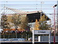
Crewe Alexandra Football Club's main stand
Crewe Alexandra, Cheshire's Premier football club, captured from the town's railway station...
Image: © Crewe blog
Taken: 18 Sep 2006
0.11 miles